Särna geodata
Särna (Dalarna) is a populated place; located in Sweden in Europe/Stockholm (GMT+2) time zone. With population of 675 people, there are 1093 cities with bigger population in this country. Compared to other cities in Sweden, 84.5% of cities are located further ↓South; 76.3% of cities are located further →East and 99.3% of cities have lower elevation than Särna. Note1


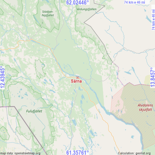
Särna GPS coordinates[2]
61° 41' 34.224" North, 13° 8' 33.252" East
| Map corner | latitude | longitude |
|---|---|---|
| Upper-left | 62.02446°, | 12.43945° |
| Center: | 61.69284°, | 13.14257° |
| Lower-right: | 61.35761°, | 13.8457° |
| Map W x H: | 74.1×74.1 km | = 46×46mi |
| max Lat: | 67.85572° ⇑15.5% North |
| Särna: | 61.69284° |
| min Lat: | ⇓84.5% South 55.34337° |
| min Long | Särna | max Long |
| 11.1712° | 13.14257° | 24.13676° |
| W 23.7%⇐ | ⇒76.3% E |
Elevation
Elevation of Särna is 424 m = 1391 ft, and this is 341.4 m = 1120 ft above average elevation for this country.
| Max E: |
663 m = 2175 ft | 0.7% |
| Särna | 424 m 1391 ft | |
| Avg. | 82.6 m = 271 ft | |
Min E: |
-1 m = -3 ft | 99.3% |
See also: Sweden elevation on elevation.city.
Geographical zone
Särna is located in North temperate zone (between Tropic of Cancer and the Arctic Circle). Distance of this North polar circle is 541.6 km =336.5 mi to North.| Distance of | km | miles | from Särna |
|---|---|---|---|
| North Pole | 3147.5 | 1955.8 | to North |
| Arctic Circle | 541.6 | 336.5 | to North |
| Tropic Cancer | 4253.7 | 2643.1 | to South |
| Equator | 6859.6 | 4262.4 | to South |


Nearby cities:
15 places around Särna: (largest is in red/bold)
• Funäsdalen
99.9 km =62.1 mi,  341°
341°
• Hede
82.4 km =51.2 mi,  13°
13°
• Idre
29.1 km =18.1 mi,  309°
309°
• Malungsfors
108.9 km =67.7 mi,  168°
168°
• Mora
106.7 km =66.3 mi,  135°
135°
• Orsa
101 km =62.8 mi,  129°
129°
• Rot
68.3 km =42.4 mi, 136°
• Selja
103.1 km =64.1 mi, 136°
• Sveg
74.5 km =46.3 mi,  59°
59°
• Sälen
60.7 km =37.7 mi, 173°
• Vemdalen
92.2 km =57.3 mi,  24°
24°
• Våmhus
95.6 km =59.4 mi, 132°
• Ytterhogdal
108.3 km =67.3 mi, 60°
• Älvdalen
70.3 km =43.7 mi, 137°
• Östnor
102.4 km =63.6 mi, 135°
Sources, notices
• [Note1] Compared only with cities in Sweden existing in our database
• [Src1] Map data: © OpenStreetMap contributors (CC-BY-SA)
• [Src2] Other city data from geonames.org with taken over terms of usage.
• [Src3] Geographical zone / Annual Mean Temperature by Robert A. Rohde @ Wikipedia
