Hede geodata
Hede (Jämtland) is a populated place; located in Sweden in Europe/Stockholm (GMT+2) time zone. With population of 837 people, there are 938 cities with bigger population in this country. Compared to other cities in Sweden, 86.8% of cities are located further ↓South; 71% of cities are located further →East and 99.5% of cities have lower elevation than Hede. Note1


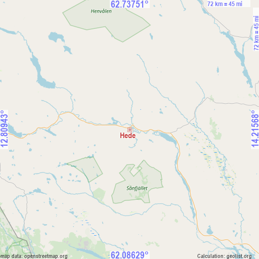
Hede GPS coordinates[2]
62° 24' 49.212" North, 13° 30' 45.18" East
| Map corner | latitude | longitude |
|---|---|---|
| Upper-left | 62.73751°, | 12.80943° |
| Center: | 62.41367°, | 13.51255° |
| Lower-right: | 62.08629°, | 14.21568° |
| Map W x H: | 72.4×72.4 km | = 45×45mi |
| max Lat: | 67.85572° ⇑13.2% North |
| Hede: | 62.41367° |
| min Lat: | ⇓86.8% South 55.34337° |
| min Long | Hede | max Long |
| 11.1712° | 13.51255° | 24.13676° |
| W 29%⇐ | ⇒71% E |
Elevation
Elevation of Hede is 434 m = 1424 ft, and this is 351.4 m = 1153 ft above average elevation for this country.
| Max E: |
663 m = 2175 ft | 0.5% |
| Hede | 434 m 1424 ft | |
| Avg. | 82.6 m = 271 ft | |
Min E: |
-1 m = -3 ft | 99.5% |
See also: Sweden elevation on elevation.city.
Geographical zone
Hede is located in North temperate zone (between Tropic of Cancer and the Arctic Circle). Distance of this North polar circle is 461.4 km =286.7 mi to North.| Distance of | km | miles | from Hede |
|---|---|---|---|
| North Pole | 3067.3 | 1905.9 | to North |
| Arctic Circle | 461.4 | 286.7 | to North |
| Tropic Cancer | 4333.8 | 2692.9 | to South |
| Equator | 6939.7 | 4312.1 | to South |


Nearby cities:
15 places around Hede: (largest is in red/bold)
• Brunflo
99.7 km =62 mi,  42°
42°
• Funäsdalen
52 km =32.3 mi,  286°
286°
• Hackås
75.9 km =47.2 mi, 42°
• Hoverberg
65.3 km =40.6 mi,  47°
47°
• Hållsta
98.7 km =61.3 mi, 48°
• Idre
74.4 km =46.2 mi,  213°
213°
• Järpen
103.7 km =64.4 mi,  358°
358°
• Mörsil
99.9 km =62.1 mi,  4°
4°
• Sveg
61.1 km =38 mi,  133°
133°
• Svenstavik
61.4 km =38.2 mi, 50°
• Särna
82.4 km =51.2 mi,  193°
193°
• Undersåker
101.4 km =63 mi,  352°
352°
• Vemdalen
18.7 km =11.6 mi,  77°
77°
• Ytterhogdal
78.5 km =48.8 mi,  109°
109°
• Östersund
102.5 km =63.7 mi,  33°
33°
Sources, notices
• [Note1] Compared only with cities in Sweden existing in our database
• [Src1] Map data: © OpenStreetMap contributors (CC-BY-SA)
• [Src2] Other city data from geonames.org with taken over terms of usage.
• [Src3] Geographical zone / Annual Mean Temperature by Robert A. Rohde @ Wikipedia
