Sandared geodata
Sandared (Västra Götaland) is a populated place; located in Sweden in Europe/Stockholm (GMT+2) time zone. With population of 2,993 people, there are 405 cities with bigger population in this country. Compared to other cities in Sweden, 67.1% of cities are located further ↑North; 84.9% of cities are located further →East and 83.3% of cities have lower elevation than Sandared. Note1


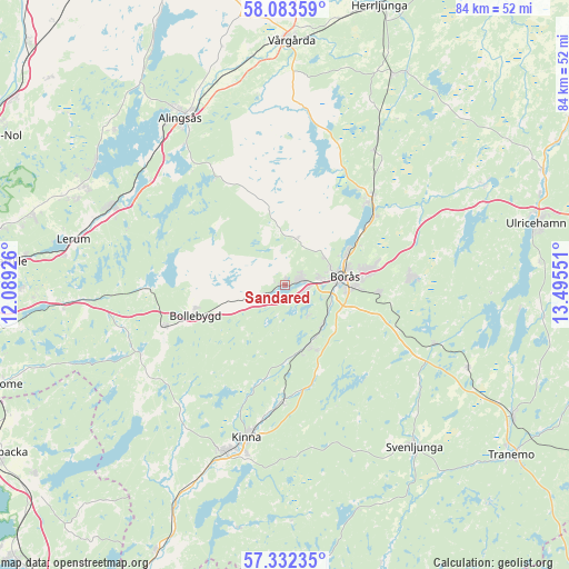
Sandared GPS coordinates[2]
57° 42' 35.712" North, 12° 47' 32.568" East
| Map corner | latitude | longitude |
|---|---|---|
| Upper-left | 58.08359°, | 12.08926° |
| Center: | 57.70992°, | 12.79238° |
| Lower-right: | 57.33235°, | 13.49551° |
| Map W x H: | 83.5×83.5 km | = 51.9×51.9mi |
| max Lat: | 67.85572° ⇑67.1% North |
| Sandared: | 57.70992° |
| min Lat: | ⇓32.9% South 55.34337° |
| min Long | Sandared | max Long |
| 11.1712° | 12.79238° | 24.13676° |
| W 15.1%⇐ | ⇒84.9% E |
Elevation
Elevation of Sandared is 161 m = 528 ft, and this is 78.4 m = 257 ft above average elevation for this country.
| Max E: |
663 m = 2175 ft | 16.7% |
| Sandared | 161 m 528 ft | |
| Avg. | 82.6 m = 271 ft | |
Min E: |
-1 m = -3 ft | 83.3% |
See also: Sweden elevation on elevation.city.
Geographical zone
Sandared is located in North temperate zone (between Tropic of Cancer and the Arctic Circle). Distance of this North polar circle is 984.4 km =611.7 mi to North.| Distance of | km | miles | from Sandared |
|---|---|---|---|
| North Pole | 3590.3 | 2230.9 | to North |
| Arctic Circle | 984.4 | 611.7 | to North |
| Tropic Cancer | 3810.8 | 2367.9 | to South |
| Equator | 6416.7 | 3987.2 | to South |


Nearby cities:
15 places around Sandared: (largest is in red/bold)
• Bollebygd
13.8 km =8.6 mi,  250°
250°
• Borås
8.9 km =5.5 mi,  81°
81°
• Dalsjöfors
17.3 km =10.7 mi,  87°
87°
• Fristad
18.2 km =11.3 mi,  45°
45°
• Fritsla
17.1 km =10.6 mi,  181°
181°
• Frufällan
13.2 km =8.2 mi, 51°
• Gånghester
13.4 km =8.3 mi, 94°
• Målsryd
15.6 km =9.7 mi,  100°
100°
• Olsfors
6 km =3.7 mi, 249°
• Rydboholm
8.6 km =5.3 mi,  140°
140°
• Rävlanda
18.6 km =11.6 mi, 250°
• Sandhult
6.5 km =4 mi,  12°
12°
• Sjömarken
2.6 km =1.6 mi, 76°
• Svaneholm
10.5 km =6.5 mi,  172°
172°
• Viskafors
9.6 km =6 mi,  159°
159°
Sources, notices
• [Note1] Compared only with cities in Sweden existing in our database
• [Src1] Map data: © OpenStreetMap contributors (CC-BY-SA)
• [Src2] Other city data from geonames.org with taken over terms of usage.
• [Src3] Geographical zone / Annual Mean Temperature by Robert A. Rohde @ Wikipedia
