Berga geodata
Berga (Kalmar) is a populated place; located in Sweden in Europe/Stockholm (GMT+2) time zone. With population of 713 people, there are 1050 cities with bigger population in this country. Compared to other cities in Sweden, 75.4% of cities are located further ↑North; 62.3% of cities are located further ←West and 69.3% of cities have lower elevation than Berga. Note1


Berga GPS coordinates[2]
57° 13' 0.012" North, 16° 1' 59.988" East
| Map corner | latitude | longitude |
|---|---|---|
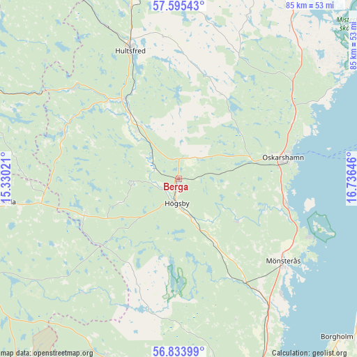
| Upper-left | 57.59543°, | 15.33021° |
| Center: | 57.21667°, | 16.03333° |
| Lower-right: | 56.83399°, | 16.73646° |
| Map W x H: | 84.7×84.7 km | = 52.6×52.6mi |
| max Lat: | 67.85572° ⇑75.4% North |
| Berga: | 57.21667° |
| min Lat: | ⇓24.6% South 55.34337° |
| min Long | Berga | max Long |
| 11.1712° | 16.03333° | 24.13676° |
| W 62.3%⇐ | ⇒37.7% E |
Elevation
Elevation of Berga is 97 m = 318 ft, and this is 14.4 m = 47 ft above average elevation for this country.
| Max E: |
663 m = 2175 ft | 30.7% |
| Berga | 97 m 318 ft | |
| Avg. | 82.6 m = 271 ft | |
Min E: |
-1 m = -3 ft | 69.3% |
See also: Sweden elevation on elevation.city.
Geographical zone
Berga is located in North temperate zone (between Tropic of Cancer and the Arctic Circle). Distance of this North polar circle is 1039.3 km =645.8 mi to North.| Distance of | km | miles | from Berga |
|---|---|---|---|
| North Pole | 3645.2 | 2265 | to North |
| Arctic Circle | 1039.3 | 645.8 | to North |
| Tropic Cancer | 3756 | 2333.9 | to South |
| Equator | 6361.9 | 3953.1 | to South |


Nearby cities:
15 places around Berga: (largest is in red/bold)
• Alstermo
35.5 km =22.1 mi,  220°
220°
• Blomstermåla
31.6 km =19.6 mi,  145°
145°
• Figeholm
35.2 km =21.9 mi,  61°
61°
• Fliseryd
16.8 km =10.4 mi,  123°
123°
• Hultsfred
32.3 km =20.1 mi,  339°
339°
• Högsby
5.7 km =3.5 mi,  184°
184°
• Järnforsen
33.5 km =20.8 mi,  311°
311°
• Kristdala
22.9 km =14.2 mi,  26°
26°
• Målilla
23.4 km =14.5 mi,  324°
324°
• Mönsterås
31.6 km =19.6 mi,  128°
128°
• Mörlunda
15.7 km =9.8 mi, 315°
• Oskarshamn
25.5 km =15.8 mi,  77°
77°
• Påskallavik
25.7 km =16 mi,  102°
102°
• Ruda
12.9 km =8 mi,  157°
157°
• Virserum
29.3 km =18.2 mi,  292°
292°
Sources, notices
• [Note1] Compared only with cities in Sweden existing in our database
• [Src1] Map data: © OpenStreetMap contributors (CC-BY-SA)
• [Src2] Other city data from geonames.org with taken over terms of usage.
• [Src3] Geographical zone / Annual Mean Temperature by Robert A. Rohde @ Wikipedia
