Hultsfred geodata
Hultsfred (Kalmar) is a seat of a second-order administrative division; located in Sweden in Europe/Stockholm (GMT+2) time zone. With population of 5,510 people, there are 251 cities with bigger population in this country. Compared to other cities in Sweden, 71.9% of cities are located further ↑North; 60.1% of cities are located further ←West and 71.6% of cities have lower elevation than Hultsfred. Note1


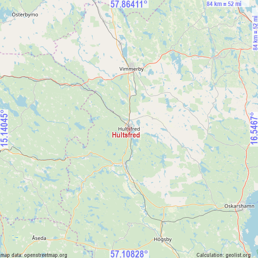
Hultsfred GPS coordinates[2]
57° 29' 17.34" North, 15° 50' 36.852" East
| Map corner | latitude | longitude |
|---|---|---|
| Upper-left | 57.86411°, | 15.14045° |
| Center: | 57.48815°, | 15.84357° |
| Lower-right: | 57.10828°, | 16.5467° |
| Map W x H: | 84×84 km | = 52.2×52.2mi |
| max Lat: | 67.85572° ⇑71.9% North |
| Hultsfred: | 57.48815° |
| min Lat: | ⇓28.1% South 55.34337° |
| min Long | Hultsfred | max Long |
| 11.1712° | 15.84357° | 24.13676° |
| W 60.1%⇐ | ⇒39.9% E |
Elevation
Elevation of Hultsfred is 104 m = 341 ft, and this is 21.4 m = 70 ft above average elevation for this country.
| Max E: |
663 m = 2175 ft | 28.4% |
| Hultsfred | 104 m 341 ft | |
| Avg. | 82.6 m = 271 ft | |
Min E: |
-1 m = -3 ft | 71.6% |
See also: Sweden elevation on elevation.city.
Geographical zone
Hultsfred is located in North temperate zone (between Tropic of Cancer and the Arctic Circle). Distance of this North polar circle is 1009.1 km =627 mi to North.| Distance of | km | miles | from Hultsfred |
|---|---|---|---|
| North Pole | 3615 | 2246.3 | to North |
| Arctic Circle | 1009.1 | 627 | to North |
| Tropic Cancer | 3786.2 | 2352.6 | to South |
| Equator | 6392.1 | 3971.9 | to South |


Nearby cities:
15 places around Hultsfred: (largest is in red/bold)
• Ankarsrum
37.5 km =23.3 mi,  51°
51°
• Berga
32.3 km =20.1 mi,  159°
159°
• Gullringen
35.7 km =22.2 mi,  346°
346°
• Holsbybrunn
39 km =24.2 mi,  261°
261°
• Högsby
37.5 km =23.3 mi, 163°
• Järnforsen
15.7 km =9.8 mi,  239°
239°
• Kristdala
23.7 km =14.7 mi,  114°
114°
• Mariannelund
21.8 km =13.5 mi,  310°
310°
• Målilla
11.4 km =7.1 mi,  191°
191°
• Mörlunda
19.1 km =11.9 mi,  178°
178°
• Silverdalen
8.1 km =5 mi,  316°
316°
• Storebro
10.6 km =6.6 mi,  2°
2°
• Södra Vi
28.2 km =17.5 mi, 353°
• Vimmerby
19.8 km =12.3 mi, 2°
• Virserum
24.6 km =15.3 mi,  219°
219°
Sources, notices
• [Note1] Compared only with cities in Sweden existing in our database
• [Src1] Map data: © OpenStreetMap contributors (CC-BY-SA)
• [Src2] Other city data from geonames.org with taken over terms of usage.
• [Src3] Geographical zone / Annual Mean Temperature by Robert A. Rohde @ Wikipedia
