Målilla geodata
Målilla (Kalmar) is a populated place; located in Sweden in Europe/Stockholm (GMT+1) time zone. With population of 1,348 people, there are 696 cities with bigger population in this country. Compared to other cities in Sweden, 73.3% of cities are located further ↑North; 59.4% of cities are located further ←West and 69.3% of cities have lower elevation than Målilla. Note1


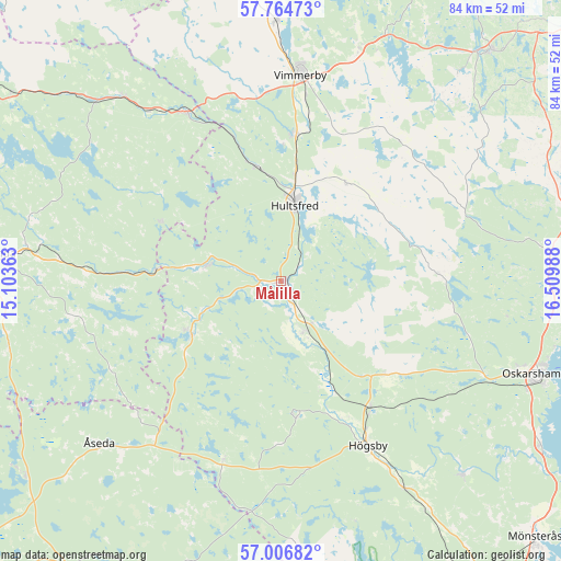
Målilla GPS coordinates[2]
57° 23' 15.828" North, 15° 48' 24.3" East
| Map corner | latitude | longitude |
|---|---|---|
| Upper-left | 57.76473°, | 15.10363° |
| Center: | 57.38773°, | 15.80675° |
| Lower-right: | 57.00682°, | 16.50988° |
| Map W x H: | 84.3×84.3 km | = 52.4×52.4mi |
| max Lat: | 67.85572° ⇑73.3% North |
| Målilla: | 57.38773° |
| min Lat: | ⇓26.7% South 55.34337° |
| min Long | Målilla | max Long |
| 11.1712° | 15.80675° | 24.13676° |
| W 59.4%⇐ | ⇒40.6% E |
Elevation
Elevation of Målilla is 97 m = 318 ft, and this is 14.4 m = 47 ft above average elevation for this country.
| Max E: |
663 m = 2175 ft | 30.7% |
| Målilla | 97 m 318 ft | |
| Avg. | 82.6 m = 271 ft | |
Min E: |
-1 m = -3 ft | 69.3% |
See also: Sweden elevation on elevation.city.
Geographical zone
Målilla is located in North temperate zone (between Tropic of Cancer and the Arctic Circle). Distance of this North polar circle is 1020.3 km =634 mi to North.| Distance of | km | miles | from Målilla |
|---|---|---|---|
| North Pole | 3626.1 | 2253.2 | to North |
| Arctic Circle | 1020.3 | 634 | to North |
| Tropic Cancer | 3775 | 2345.7 | to South |
| Equator | 6380.9 | 3964.9 | to South |


Nearby cities:
15 places around Målilla: (largest is in red/bold)
• Berga
23.4 km =14.5 mi,  144°
144°
• Holsbybrunn
36.7 km =22.8 mi,  277°
277°
• Hultsfred
11.4 km =7.1 mi,  11°
11°
• Högsby
27.9 km =17.3 mi,  151°
151°
• Järnforsen
11.8 km =7.3 mi,  285°
285°
• Kristdala
23.9 km =14.9 mi,  86°
86°
• Mariannelund
29.2 km =18.1 mi,  330°
330°
• Mörlunda
8.3 km =5.2 mi,  161°
161°
• Ruda
36.1 km =22.4 mi, 149°
• Silverdalen
17.4 km =10.8 mi,  348°
348°
• Storebro
21.9 km =13.6 mi, 6°
• Södra Vi
39.2 km =24.4 mi,  358°
358°
• Vimmerby
31.1 km =19.3 mi, 5°
• Virserum
15.6 km =9.7 mi,  239°
239°
• Åseda
36.9 km =22.9 mi,  228°
228°
Sources, notices
• [Note1] Compared only with cities in Sweden existing in our database
• [Src1] Map data: © OpenStreetMap contributors (CC-BY-SA)
• [Src2] Other city data from geonames.org with taken over terms of usage.
• [Src3] Geographical zone / Annual Mean Temperature by Robert A. Rohde @ Wikipedia
