Cankova geodata
Cankova is a seat of a first-order administrative division; located in Slovenia in Europe/Ljubljana (GMT+2) time zone. With population of 446 people, there are 559 cities with bigger population in this country. Compared to other cities in Slovenia, 98.8% of cities are located further ↓South; 89.3% of cities are located further ←West and 77.3% of cities have higher elevation than Cankova. Note1


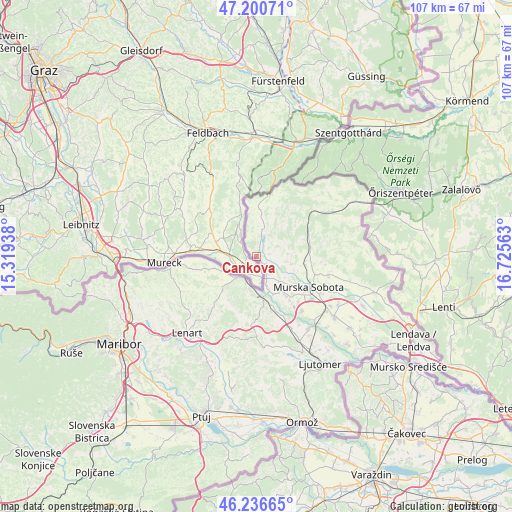
Cankova GPS coordinates[2]
46° 43' 14.988" North, 16° 1' 21" East
| Map corner | latitude | longitude |
|---|---|---|
| Upper-left | 47.20071°, | 15.31938° |
| Center: | 46.72083°, | 16.0225° |
| Lower-right: | 46.23665°, | 16.72563° |
| Map W x H: | 107.2×107.2 km | = 66.6×66.6mi |
| max Lat: | 46.83694° ⇑1.2% North |
| Cankova: | 46.72083° |
| min Lat: | ⇓98.8% South 45.47667° |
| min Long | Cankova | max Long |
| 13.52639° | 16.0225° | 16.4975° |
| W 89.3%⇐ | ⇒10.7% E |
Elevation
Elevation of Cankova is 215 m = 705 ft, and this is 110.6 m = 363 ft below average elevation for this country.
| Max E: |
1551 m = 5089 ft | 77.3% |
| Avg. | 325.6 m = 1068 ft | |
| Cankova | 215 m = 705 ft | |
Min E: |
2 m = 7 ft | 22.7% |
See also: Slovenia elevation on elevation.city.
Geographical zone
Cankova is located in North temperate zone (between Tropic of Cancer and the Arctic Circle). Distance of this North polar circle is 2206.3 km =1370.9 mi to North.| Distance of | km | miles | from Cankova |
|---|---|---|---|
| North Pole | 4812.2 | 2990.2 | to North |
| Arctic Circle | 2206.3 | 1370.9 | to North |
| Tropic Cancer | 2589 | 1608.7 | to South |
| Equator | 5194.9 | 3228 | to South |


Nearby cities:
15 places around Cankova: (largest is in red/bold)
• Apače
8.9 km =5.5 mi,  252°
252°
• Gornja Radgona
5.8 km =3.6 mi,  203°
203°
• Grad
10.6 km =6.6 mi,  33°
33°
• Krog
12.9 km =8 mi,  135°
135°
• Murska Sobota
12.7 km =7.9 mi,  120°
120°
• Petanjci
8.2 km =5.1 mi,  156°
156°
• Puconci
10.3 km =6.4 mi,  98°
98°
• Pušča
11.5 km =7.1 mi,  129°
129°
• Radenci
8.8 km =5.5 mi,  172°
172°
• Rogašovci
8.8 km =5.5 mi,  5°
5°
• Serdica
10.9 km =6.8 mi,  3°
3°
• Tišina
8.7 km =5.4 mi, 142°
• Tropovci
9.7 km =6 mi, 140°
• Černelavci
10.4 km =6.5 mi, 125°
• Črešnjevci
7.6 km =4.7 mi, 195°
Sources, notices
• [Note1] Compared only with cities in Slovenia existing in our database
• [Src1] Map data: © OpenStreetMap contributors (CC-BY-SA)
• [Src2] Other city data from geonames.org with taken over terms of usage.
• [Src3] Geographical zone / Annual Mean Temperature by Robert A. Rohde @ Wikipedia
