Gornja Radgona geodata
Gornja Radgona is a seat of a first-order administrative division; located in Slovenia in Europe/Ljubljana (GMT+2) time zone. With population of 3,159 people, there are 64 cities with bigger population in this country. Compared to other cities in Slovenia, 96.8% of cities are located further ↓South; 88.5% of cities are located further ←West and 77.7% of cities have higher elevation than Gornja Radgona. Note1


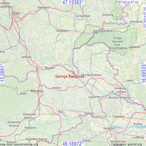
Gornja Radgona GPS coordinates[2]
46° 40' 23.988" North, 15° 59' 31.992" East
| Map corner | latitude | longitude |
|---|---|---|
| Upper-left | 47.15363°, | 15.2891° |
| Center: | 46.67333°, | 15.99222° |
| Lower-right: | 46.18872°, | 16.69535° |
| Map W x H: | 107.3×107.3 km | = 66.7×66.7mi |
| max Lat: | 46.83694° ⇑3.2% North |
| Gornja Radgona: | 46.67333° |
| min Lat: | ⇓96.8% South 45.47667° |
| min Long | Gornja Radgona | max Long |
| 13.52639° | 15.99222° | 16.4975° |
| W 88.5%⇐ | ⇒11.5% E |
Elevation
Elevation of Gornja Radgona is 214 m = 702 ft, and this is 111.6 m = 366 ft below average elevation for this country.
| Max E: |
1551 m = 5089 ft | 77.7% |
| Avg. | 325.6 m = 1068 ft | |
| Gornja Radgona | 214 m = 702 ft | |
Min E: |
2 m = 7 ft | 22.3% |
See also: Slovenia elevation on elevation.city.
Geographical zone
Gornja Radgona is located in North temperate zone (between Tropic of Cancer and the Arctic Circle). Distance of this North polar circle is 2211.6 km =1374.2 mi to North.| Distance of | km | miles | from Gornja Radgona |
|---|---|---|---|
| North Pole | 4817.5 | 2993.5 | to North |
| Arctic Circle | 2211.6 | 1374.2 | to North |
| Tropic Cancer | 2583.7 | 1605.4 | to South |
| Equator | 5189.6 | 3224.7 | to South |


Nearby cities:
15 places around Gornja Radgona: (largest is in red/bold)
• Apače
6.8 km =4.2 mi,  293°
293°
• Benedikt
10.7 km =6.6 mi,  227°
227°
• Cankova
5.8 km =3.6 mi,  23°
23°
• Cerkvenjak
12 km =7.5 mi,  197°
197°
• Krog
12 km =7.5 mi,  109°
109°
• Petanjci
6.1 km =3.8 mi, 111°
• Pušča
11.4 km =7.1 mi,  99°
99°
• Radenci
4.9 km =3 mi,  135°
135°
• Sv. Ana v Slov. Goricah
11.6 km =7.2 mi,  256°
256°
• Sveti Jurij ob Ščavnici
11.8 km =7.3 mi,  168°
168°
• Tišina
7.8 km =4.8 mi, 102°
• Tropovci
8.8 km =5.5 mi, 104°
• Zgornja Ščavnica
11.6 km =7.2 mi, 261°
• Černelavci
10.8 km =6.7 mi,  93°
93°
• Črešnjevci
2.1 km =1.3 mi, 172°
Sources, notices
• [Note1] Compared only with cities in Slovenia existing in our database
• [Src1] Map data: © OpenStreetMap contributors (CC-BY-SA)
• [Src2] Other city data from geonames.org with taken over terms of usage.
• [Src3] Geographical zone / Annual Mean Temperature by Robert A. Rohde @ Wikipedia
