Nemšová geodata
Nemšová (Trenčiansky kraj) is a seat of a third-order administrative division; located in Slovakia in Europe/Bratislava (GMT+2) time zone. With population of 6,136 people, there are 98 cities with bigger population in this country. Compared to other cities in Slovakia, 64.1% of cities are located further ↓South; 77.1% of cities are located further →East and 58.8% of cities have higher elevation than Nemšová. Note1


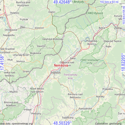
Nemšová GPS coordinates[2]
48° 58' 1.272" North, 18° 7' 8.112" East
| Map corner | latitude | longitude |
|---|---|---|
| Upper-left | 49.42648°, | 17.4158° |
| Center: | 48.96702°, | 18.11892° |
| Lower-right: | 48.50329°, | 18.82205° |
| Map W x H: | 102.6×102.6 km | = 63.8×63.8mi |
| max Lat: | 49.43503° ⇑35.9% North |
| Nemšová: | 48.96702° |
| min Lat: | ⇓64.1% South 47.76356° |
| min Long | Nemšová | max Long |
| 16.9786° | 18.11892° | 22.18136° |
| W 22.9%⇐ | ⇒77.1% E |
Elevation
Elevation of Nemšová is 226 m = 741 ft, and this is 110.1 m = 361 ft below average elevation for this country.
| Max E: |
1006 m = 3301 ft | 58.8% |
| Avg. | 336.1 m = 1103 ft | |
| Nemšová | 226 m = 741 ft | |
Min E: |
102 m = 335 ft | 41.2% |
See also: Slovakia elevation on elevation.city.
Geographical zone
Nemšová is located in North temperate zone (between Tropic of Cancer and the Arctic Circle). Distance of this North polar circle is 1956.6 km =1215.8 mi to North.| Distance of | km | miles | from Nemšová |
|---|---|---|---|
| North Pole | 4562.4 | 2834.9 | to North |
| Arctic Circle | 1956.6 | 1215.8 | to North |
| Tropic Cancer | 2838.7 | 1763.9 | to South |
| Equator | 5444.6 | 3383.1 | to South |


Nearby cities:
15 places around Nemšová: (largest is in red/bold)
• Bojnice
39.7 km =24.7 mi,  120°
120°
• Bánovce nad Bebravou
29.1 km =18.1 mi,  159°
159°
• Dubnica nad Váhom
3.6 km =2.2 mi,  103°
103°
• Ilava
9.2 km =5.7 mi,  68°
68°
• Nová Dubnica
4.1 km =2.5 mi,  150°
150°
• Nováky
41.6 km =25.8 mi,  133°
133°
• Nové Mesto nad Váhom
31.4 km =19.5 mi,  222°
222°
• Partizánske
42.4 km =26.3 mi, 152°
• Považská Bystrica
28 km =17.4 mi,  52°
52°
• Púchov
23.2 km =14.4 mi,  40°
40°
• Rajec
40.3 km =25 mi, 70°
• Stará Turá
37.5 km =23.3 mi,  235°
235°
• Trenčianske Teplice
7.2 km =4.5 mi, 150°
• Trenčín
9.7 km =6 mi,  214°
214°
• Čachtice
37.3 km =23.2 mi, 220°
Sources, notices
• [Note1] Compared only with cities in Slovakia existing in our database
• [Src1] Map data: © OpenStreetMap contributors (CC-BY-SA)
• [Src2] Other city data from geonames.org with taken over terms of usage.
• [Src3] Geographical zone / Annual Mean Temperature by Robert A. Rohde @ Wikipedia
