Púchov geodata
Púchov (Trenčiansky kraj) is a seat of a second-order administrative division; located in Slovakia in Europe/Bratislava (GMT+2) time zone. With population of 18,833 people, there are 43 cities with bigger population in this country. Compared to other cities in Slovakia, 80.6% of cities are located further ↓South; 69.4% of cities are located further →East and 51.2% of cities have higher elevation than Púchov. Note1


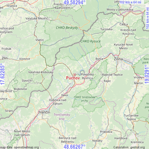
Púchov GPS coordinates[2]
49° 7' 29.784" North, 18° 19' 33.492" East
| Map corner | latitude | longitude |
|---|---|---|
| Upper-left | 49.58294°, | 17.62285° |
| Center: | 49.12494°, | 18.32597° |
| Lower-right: | 48.66267°, | 19.0291° |
| Map W x H: | 102.3×102.3 km | = 63.6×63.6mi |
| max Lat: | 49.43503° ⇑19.4% North |
| Púchov: | 49.12494° |
| min Lat: | ⇓80.6% South 47.76356° |
| min Long | Púchov | max Long |
| 16.9786° | 18.32597° | 22.18136° |
| W 30.6%⇐ | ⇒69.4% E |
Elevation
Elevation of Púchov is 264 m = 866 ft, and this is 72.1 m = 237 ft below average elevation for this country.
| Max E: |
1006 m = 3301 ft | 51.2% |
| Avg. | 336.1 m = 1103 ft | |
| Púchov | 264 m = 866 ft | |
Min E: |
102 m = 335 ft | 48.8% |
See also: Slovakia elevation on elevation.city.
Geographical zone
Púchov is located in North temperate zone (between Tropic of Cancer and the Arctic Circle). Distance of this North polar circle is 1939 km =1204.8 mi to North.| Distance of | km | miles | from Púchov |
|---|---|---|---|
| North Pole | 4544.9 | 2824.1 | to North |
| Arctic Circle | 1939 | 1204.8 | to North |
| Tropic Cancer | 2856.3 | 1774.8 | to South |
| Equator | 5462.2 | 3394.1 | to South |


Nearby cities:
15 places around Púchov: (largest is in red/bold)
• Bojnice
42.3 km =26.3 mi,  153°
153°
• Bytča
20.2 km =12.6 mi,  56°
56°
• Dubnica nad Váhom
21.7 km =13.5 mi,  212°
212°
• Ilava
15.6 km =9.7 mi, 205°
• Krasňany
42 km =26.1 mi,  76°
76°
• Kysucké Nové Mesto
38.5 km =23.9 mi, 59°
• Nemšová
23.2 km =14.4 mi,  220°
220°
• Nová Dubnica
24.9 km =15.5 mi, 211°
• Považská Bystrica
7 km =4.3 mi,  93°
93°
• Rajec
23.2 km =14.4 mi,  99°
99°
• Trenčianske Teplice
26.5 km =16.5 mi, 205°
• Trenčín
32.8 km =20.4 mi, 218°
• Turzovka
37.8 km =23.5 mi,  34°
34°
• Vrútky
43 km =26.7 mi, 91°
• Žilina
32 km =19.9 mi,  70°
70°
Sources, notices
• [Note1] Compared only with cities in Slovakia existing in our database
• [Src1] Map data: © OpenStreetMap contributors (CC-BY-SA)
• [Src2] Other city data from geonames.org with taken over terms of usage.
• [Src3] Geographical zone / Annual Mean Temperature by Robert A. Rohde @ Wikipedia
