Freetown geodata
Freetown (Western Area) is a capital of a political entity; located in Sierra Leone in Africa/Freetown (GMT+0) time zone. With population of 802,639 people, there are 0 cities with bigger population in this country. Compared to other cities in Sierra Leone, 56.6% of cities are located further ↓South; 97.6% of cities are located further →East and 90.4% of cities have higher elevation than Freetown. Note1


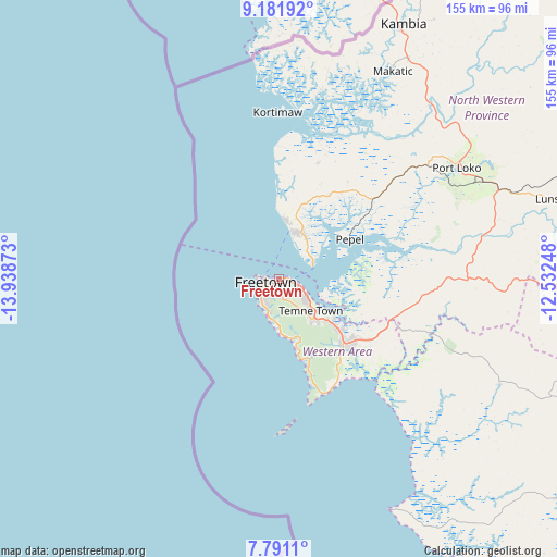
Freetown GPS coordinates[2]
8° 29' 13.704" North, 13° 14' 8.16" West
| Map corner | latitude | longitude |
|---|---|---|
| Upper-left | 9.18192°, | -13.93873° |
| Center: | 8.48714°, | -13.2356° |
| Lower-right: | 7.7911°, | -12.53248° |
| Map W x H: | 154.6×154.6 km | = 96.1×96.1mi |
| max Lat: | 9.91376° ⇑43.4% North |
| Freetown: | 8.48714° |
| min Lat: | ⇓56.6% South 7.24611° |
| min Long | Freetown | max Long |
| -13.28972° | -13.2356° | -10.37135° |
| W 2.4%⇐ | ⇒97.6% E |
Elevation
Elevation of Freetown is 21 m = 69 ft, and this is 136.2 m = 447 ft below average elevation for this country.
| Max E: |
564 m = 1850 ft | 90.4% |
| Avg. | 157.2 m = 516 ft | |
| Freetown | 21 m = 69 ft | |
Min E: |
1 m = 3 ft | 9.6% |
See also: Freetown elevation on elevation.city.
Geographical zone
Freetown is located in North Torrid zone (between Equator and Tropic of Cancer). Distance of Equator is 943.7 km =586.4 mi to South.| Distance of | km | miles | from Freetown |
|---|---|---|---|
| North Pole | 9063.4 | 5631.7 | to North |
| Arctic Circle | 6457.5 | 4012.5 | to North |
| Tropic Cancer | 1662.2 | 1032.8 | to North |
| Equator | 943.7 | 586.4 | to South |


Nearby cities:
15 places around Freetown: (largest is in red/bold)
• Freetown
8.5 km =5.3 mi,  224°
224°
• Hastings
16.1 km =10 mi,  137°
137°
• Kambia
79 km =49.1 mi,  26°
26°
• Kassiri
51.9 km =32.2 mi,  14°
14°
• Kent
25.3 km =15.7 mi,  132°
132°
• Konakridee
23.4 km =14.5 mi,  359°
359°
• Mambolo
52.7 km =32.7 mi,  24°
24°
• Mange
63.9 km =39.7 mi,  40°
40°
• Masoyila
14.6 km =9.1 mi, 19°
• Pepel
22.8 km =14.2 mi,  61°
61°
• Port Loko
58.3 km =36.2 mi, 57°
• Rotifunk
67.9 km =42.2 mi,  115°
115°
• Sawkta
16.5 km =10.3 mi, 12°
• Tintafor
15.7 km =9.8 mi, 8°
• Waterloo
24.5 km =15.2 mi, 132°
Sources, notices
• [Note1] Compared only with cities in Sierra Leone existing in our database
• [Src1] Map data: © OpenStreetMap contributors (CC-BY-SA)
• [Src2] Other city data from geonames.org with taken over terms of usage.
• [Src3] Geographical zone / Annual Mean Temperature by Robert A. Rohde @ Wikipedia
