Rotifunk geodata
Rotifunk (Southern Province) is a populated place; located in Sierra Leone in Africa/Freetown (GMT+0) time zone. With population of 4,858 people, there are 47 cities with bigger population in this country. Compared to other cities in Sierra Leone, 56.6% of cities are located further ↑North; 81.9% of cities are located further →East and 97.6% of cities have higher elevation than Rotifunk. Note1


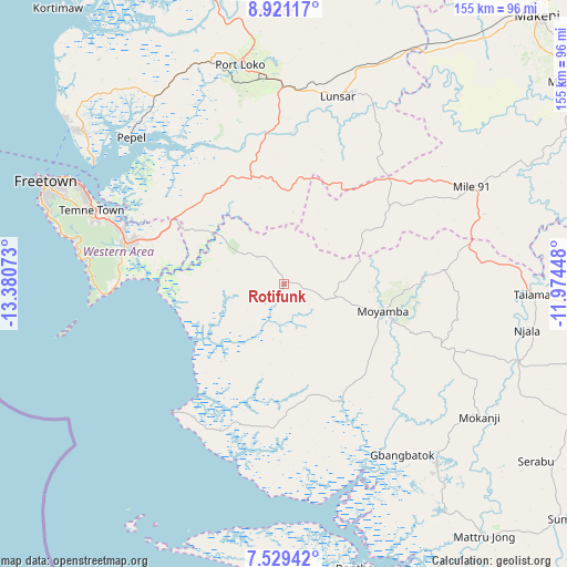
Rotifunk GPS coordinates[2]
8° 13' 33.276" North, 12° 40' 39.36" West
| Map corner | latitude | longitude |
|---|---|---|
| Upper-left | 8.92117°, | -13.38073° |
| Center: | 8.22591°, | -12.6776° |
| Lower-right: | 7.52942°, | -11.97448° |
| Map W x H: | 154.7×154.8 km | = 96.1×96.2mi |
| max Lat: | 9.91376° ⇑56.6% North |
| Rotifunk: | 8.22591° |
| min Lat: | ⇓43.4% South 7.24611° |
| min Long | Rotifunk | max Long |
| -13.28972° | -12.6776° | -10.37135° |
| W 18.1%⇐ | ⇒81.9% E |
Elevation
Elevation of Rotifunk is 14 m = 46 ft, and this is 143.2 m = 470 ft below average elevation for this country.
| Max E: |
564 m = 1850 ft | 97.6% |
| Avg. | 157.2 m = 516 ft | |
| Rotifunk | 14 m = 46 ft | |
Min E: |
1 m = 3 ft | 2.4% |
See also: Sierra Leone elevation on elevation.city.
Geographical zone
Rotifunk is located in North Torrid zone (between Equator and Tropic of Cancer). Distance of Equator is 914.6 km =568.3 mi to South.| Distance of | km | miles | from Rotifunk |
|---|---|---|---|
| North Pole | 9092.4 | 5649.8 | to North |
| Arctic Circle | 6486.5 | 4030.5 | to North |
| Tropic Cancer | 1691.3 | 1050.9 | to North |
| Equator | 914.6 | 568.3 | to South |


Nearby cities:
15 places around Rotifunk: (largest is in red/bold)
• Freetown
67.9 km =42.2 mi,  295°
295°
• Freetown
71.1 km =44.2 mi,  288°
288°
• Hastings
53.4 km =33.2 mi, 288°
• Kent
44.4 km =27.6 mi, 285°
• Largo
57.5 km =35.7 mi,  84°
84°
• Lunsar
53.3 km =33.1 mi,  17°
17°
• Masoyila
70.9 km =44.1 mi,  307°
307°
• Mogbwemo
65.6 km =40.8 mi,  141°
141°
• Moyamba
28.1 km =17.5 mi,  105°
105°
• Pepel
57.6 km =35.8 mi, 314°
• Port Loko
61.3 km =38.1 mi,  348°
348°
• Rokupr
59.1 km =36.7 mi,  33°
33°
• Sawkta
73.3 km =45.5 mi, 308°
• Waterloo
45.1 km =28 mi, 286°
• Yonibana
53.9 km =33.5 mi,  63°
63°
Sources, notices
• [Note1] Compared only with cities in Sierra Leone existing in our database
• [Src1] Map data: © OpenStreetMap contributors (CC-BY-SA)
• [Src2] Other city data from geonames.org with taken over terms of usage.
• [Src3] Geographical zone / Annual Mean Temperature by Robert A. Rohde @ Wikipedia
