Berbera geodata
Berbera (Woqooyi Galbeed) is a populated place; located in Somalia in Africa/Mogadishu (GMT+3) time zone. With population of 242,344 people, there are 2 cities with bigger population in this country. Compared to other cities in Somalia, 84.9% of cities are located further ↓South; 56.6% of cities are located further →East and 83% of cities have higher elevation than Berbera. Note1


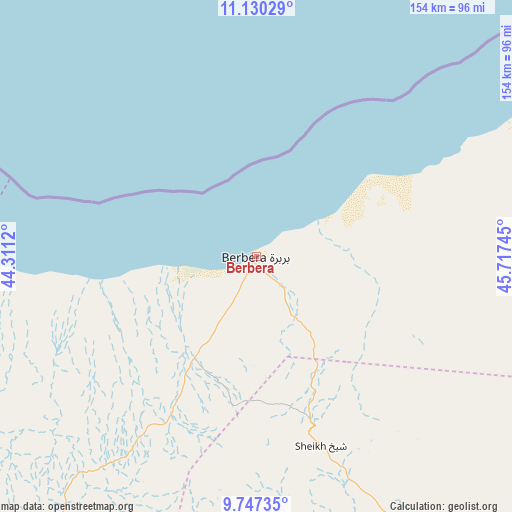
Berbera GPS coordinates[2]
10° 26' 22.524" North, 45° 0' 51.552" East
| Map corner | latitude | longitude |
|---|---|---|
| Upper-left | 11.13029°, | 44.3112° |
| Center: | 10.43959°, | 45.01432° |
| Lower-right: | 9.74735°, | 45.71745° |
| Map W x H: | 153.8×153.8 km | = 95.6×95.6mi |
| max Lat: | 11.96611° ⇑15.1% North |
| Berbera: | 10.43959° |
| min Lat: | ⇓84.9% South -1.21917° |
| min Long | Berbera | max Long |
| 41.83725° | 45.01432° | 51.0773° |
| W 43.4%⇐ | ⇒56.6% E |
Elevation
Elevation of Berbera is 11 m = 36 ft, and this is 278.9 m = 915 ft below average elevation for this country.
| Max E: |
1786 m = 5860 ft | 83% |
| Avg. | 289.9 m = 951 ft | |
| Berbera | 11 m = 36 ft | |
Min E: |
-2 m = -7 ft | 17% |
See also: Berbera elevation on elevation.city.
Geographical zone
Berbera is located in North Torrid zone (between Equator and Tropic of Cancer). Distance of Equator is 1160.8 km =721.3 mi to South.| Distance of | km | miles | from Berbera |
|---|---|---|---|
| North Pole | 8846.3 | 5496.8 | to North |
| Arctic Circle | 6240.4 | 3877.6 | to North |
| Tropic Cancer | 1445.1 | 897.9 | to North |
| Equator | 1160.8 | 721.3 | to South |


Nearby cities:
10 places around Berbera: (largest is in red/bold)
• Baki
188.4 km =117.1 mi,  251°
251°
• Baligubadle
194.9 km =121.1 mi,  214°
214°
• Burao
116.8 km =72.6 mi,  150°
150°
• Ceek
164.5 km =102.2 mi,  166°
166°
• Ceerigaabo
258 km =160.3 mi,  85°
85°
• Hargeysa
142.7 km =88.7 mi,  226°
226°
• Laascaanood
337.3 km =209.6 mi,  130°
130°
• Las Khorey
356.7 km =221.6 mi,  77°
77°
• Lughaye
120.2 km =74.7 mi,  283°
283°
• Oodweyne
114.7 km =71.3 mi,  177°
177°
Sources, notices
• [Note1] Compared only with cities in Somalia existing in our database
• [Src1] Map data: © OpenStreetMap contributors (CC-BY-SA)
• [Src2] Other city data from geonames.org with taken over terms of usage.
• [Src3] Geographical zone / Annual Mean Temperature by Robert A. Rohde @ Wikipedia
