Las Khorey geodata
Las Khorey (Sanaag) is a seat of a second-order administrative division; located in Somalia in Africa/Mogadishu (GMT+3) time zone. With population of 6,941 people, there are 38 cities with bigger population in this country. Compared to other cities in Somalia, 90.6% of cities are located further ↓South; 81.1% of cities are located further ←West and 94.3% of cities have higher elevation than Las Khorey. Note1


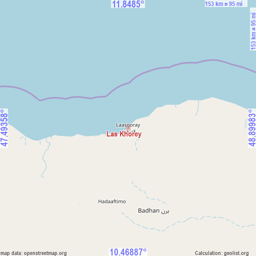
Las Khorey GPS coordinates[2]
11° 9' 34.2" North, 48° 11' 48.12" East
| Map corner | latitude | longitude |
|---|---|---|
| Upper-left | 11.8485°, | 47.49358° |
| Center: | 11.1595°, | 48.1967° |
| Lower-right: | 10.46887°, | 48.89983° |
| Map W x H: | 153.4×153.4 km | = 95.3×95.3mi |
| max Lat: | 11.96611° ⇑9.4% North |
| Las Khorey: | 11.1595° |
| min Lat: | ⇓90.6% South -1.21917° |
| min Long | Las Khorey | max Long |
| 41.83725° | 48.1967° | 51.0773° |
| W 81.1%⇐ | ⇒18.9% E |
Elevation
Elevation of Las Khorey is 6 m = 20 ft, and this is 283.9 m = 931 ft below average elevation for this country.
| Max E: |
1786 m = 5860 ft | 94.3% |
| Avg. | 289.9 m = 951 ft | |
| Las Khorey | 6 m = 20 ft | |
Min E: |
-2 m = -7 ft | 5.7% |
See also: Somalia elevation on elevation.city.
Geographical zone
Las Khorey is located in North Torrid zone (between Equator and Tropic of Cancer). Distance of Equator is 1240.8 km =771 mi to South.| Distance of | km | miles | from Las Khorey |
|---|---|---|---|
| North Pole | 8766.2 | 5447.1 | to North |
| Arctic Circle | 6160.4 | 3827.9 | to North |
| Tropic Cancer | 1365.1 | 848.2 | to North |
| Equator | 1240.8 | 771 | to South |


Nearby cities:
15 places around Las Khorey: (largest is in red/bold)
• Bandarbeyla
340.8 km =211.8 mi,  122°
122°
• Bargaal
314.5 km =195.4 mi,  87°
87°
• Berbera
356.7 km =221.6 mi,  257°
257°
• Bereeda
321.6 km =199.8 mi,  75°
75°
• Bosaso
108.3 km =67.3 mi, 82°
• Burao
343.5 km =213.4 mi,  237°
237°
• Caluula
293 km =182.1 mi,  72°
72°
• Ceek
392.7 km =244 mi,  232°
232°
• Ceerigaabo
108.8 km =67.6 mi, 236°
• Eyl
395.6 km =245.8 mi,  153°
153°
• Garoowe
308.2 km =191.5 mi,  174°
174°
• Iskushuban
242.5 km =150.7 mi,  113°
113°
• Laascaanood
312 km =193.9 mi,  197°
197°
• Oodweyne
394.1 km =244.9 mi, 240°
• Qandala
186 km =115.6 mi, 79°
Sources, notices
• [Note1] Compared only with cities in Somalia existing in our database
• [Src1] Map data: © OpenStreetMap contributors (CC-BY-SA)
• [Src2] Other city data from geonames.org with taken over terms of usage.
• [Src3] Geographical zone / Annual Mean Temperature by Robert A. Rohde @ Wikipedia
