Ceek geodata
Ceek (Togdheer) is a populated place; located in Somalia in Africa/Mogadishu (GMT+3) time zone. With population of 4,325 people, there are 45 cities with bigger population in this country. Compared to other cities in Somalia, 69.8% of cities are located further ↓South; 52.8% of cities are located further ←West and 88.7% of cities have lower elevation than Ceek. Note1


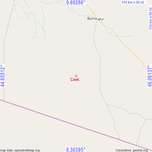
Ceek GPS coordinates[2]
8° 59' 56.652" North, 45° 21' 29.664" East
| Map corner | latitude | longitude |
|---|---|---|
| Upper-left | 9.69286°, | 44.65512° |
| Center: | 8.99907°, | 45.35824° |
| Lower-right: | 8.30395°, | 46.06137° |
| Map W x H: | 154.4×154.4 km | = 95.9×95.9mi |
| max Lat: | 11.96611° ⇑30.2% North |
| Ceek: | 8.99907° |
| min Lat: | ⇓69.8% South -1.21917° |
| min Long | Ceek | max Long |
| 41.83725° | 45.35824° | 51.0773° |
| W 52.8%⇐ | ⇒47.2% E |
Elevation
Elevation of Ceek is 865 m = 2838 ft, and this is 575.1 m = 1887 ft above average elevation for this country.
| Max E: |
1786 m = 5860 ft | 11.3% |
| Ceek | 865 m 2838 ft | |
| Avg. | 289.9 m = 951 ft | |
Min E: |
-2 m = -7 ft | 88.7% |
See also: Somalia elevation on elevation.city.
Geographical zone
Ceek is located in North Torrid zone (between Equator and Tropic of Cancer). Distance of Equator is 1000.6 km =621.7 mi to South.| Distance of | km | miles | from Ceek |
|---|---|---|---|
| North Pole | 9006.5 | 5596.4 | to North |
| Arctic Circle | 6400.6 | 3977.1 | to North |
| Tropic Cancer | 1605.3 | 997.5 | to North |
| Equator | 1000.6 | 621.7 | to South |


Nearby cities:
14 places around Ceek: (largest is in red/bold)
• Adado
347.7 km =216.1 mi,  156°
156°
• Baki
238.1 km =147.9 mi,  294°
294°
• Baligubadle
149.1 km =92.6 mi,  270°
270°
• Berbera
164.5 km =102.2 mi,  346°
346°
• Burao
61.3 km =38.1 mi,  18°
18°
• Ceerigaabo
284.3 km =176.7 mi,  50°
50°
• Dhuusamarreeb
401.4 km =249.4 mi, 163°
• Gaalkacyo
337 km =209.4 mi,  137°
137°
• Garoowe
349.8 km =217.4 mi,  100°
100°
• Hargeysa
155 km =96.3 mi, 293°
• Laascaanood
227.5 km =141.4 mi, 104°
• Las Khorey
392.7 km =244 mi, 52°
• Lughaye
243.3 km =151.2 mi,  320°
320°
• Oodweyne
55.9 km =34.7 mi, 324°
Sources, notices
• [Note1] Compared only with cities in Somalia existing in our database
• [Src1] Map data: © OpenStreetMap contributors (CC-BY-SA)
• [Src2] Other city data from geonames.org with taken over terms of usage.
• [Src3] Geographical zone / Annual Mean Temperature by Robert A. Rohde @ Wikipedia
