Laascaanood geodata
Laascaanood (Sool) is a seat of a first-order administrative division; located in Somalia in Africa/Mogadishu (GMT+3) time zone. With population of 60,100 people, there are 11 cities with bigger population in this country. Compared to other cities in Somalia, 67.9% of cities are located further ↓South; 73.6% of cities are located further ←West and 86.8% of cities have lower elevation than Laascaanood. Note1


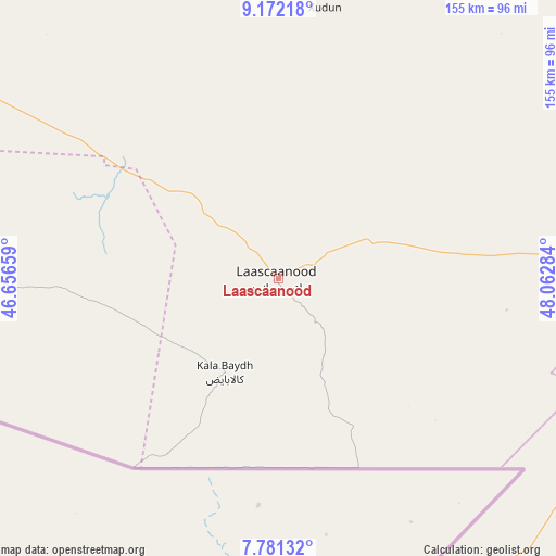
Laascaanood GPS coordinates[2]
8° 28' 38.568" North, 47° 21' 34.956" East
| Map corner | latitude | longitude |
|---|---|---|
| Upper-left | 9.17218°, | 46.65659° |
| Center: | 8.47738°, | 47.35971° |
| Lower-right: | 7.78132°, | 48.06284° |
| Map W x H: | 154.6×154.7 km | = 96.1×96.1mi |
| max Lat: | 11.96611° ⇑32.1% North |
| Laascaanood: | 8.47738° |
| min Lat: | ⇓67.9% South -1.21917° |
| min Long | Laascaanood | max Long |
| 41.83725° | 47.35971° | 51.0773° |
| W 73.6%⇐ | ⇒26.4% E |
Elevation
Elevation of Laascaanood is 692 m = 2270 ft, and this is 402.1 m = 1319 ft above average elevation for this country.
| Max E: |
1786 m = 5860 ft | 13.2% |
| Laascaanood | 692 m 2270 ft | |
| Avg. | 289.9 m = 951 ft | |
Min E: |
-2 m = -7 ft | 86.8% |
See also: Laascaanood elevation on elevation.city.
Geographical zone
Laascaanood is located in North Torrid zone (between Equator and Tropic of Cancer). Distance of Equator is 942.6 km =585.7 mi to South.| Distance of | km | miles | from Laascaanood |
|---|---|---|---|
| North Pole | 9064.5 | 5632.4 | to North |
| Arctic Circle | 6458.6 | 4013.2 | to North |
| Tropic Cancer | 1663.3 | 1033.5 | to North |
| Equator | 942.6 | 585.7 | to South |


Nearby cities:
15 places around Laascaanood: (largest is in red/bold)
• Adado
272.6 km =169.4 mi,  197°
197°
• Baligubadle
373.7 km =232.2 mi,  278°
278°
• Berbera
337.3 km =209.6 mi,  310°
310°
• Bosaso
370.4 km =230.2 mi,  32°
32°
• Burao
231.8 km =144 mi,  300°
300°
• Ceek
227.5 km =141.4 mi, 284°
• Ceerigaabo
237.8 km =147.8 mi,  0°
0°
• Dhuusamarreeb
344.2 km =213.9 mi, 198°
• Eyl
275.9 km =171.4 mi,  101°
101°
• Gaalkacyo
190 km =118.1 mi,  177°
177°
• Garoowe
123.8 km =76.9 mi,  93°
93°
• Hobyo
370.8 km =230.4 mi,  159°
159°
• Iskushuban
373.5 km =232.1 mi,  57°
57°
• Las Khorey
312 km =193.9 mi,  17°
17°
• Oodweyne
272.6 km =169.4 mi,  292°
292°
Sources, notices
• [Note1] Compared only with cities in Somalia existing in our database
• [Src1] Map data: © OpenStreetMap contributors (CC-BY-SA)
• [Src2] Other city data from geonames.org with taken over terms of usage.
• [Src3] Geographical zone / Annual Mean Temperature by Robert A. Rohde @ Wikipedia
