Oodweyne geodata
Oodweyne (Togdheer) is a populated place; located in Somalia in Africa/Mogadishu (GMT+3) time zone. With population of 5,491 people, there are 43 cities with bigger population in this country. Compared to other cities in Somalia, 73.6% of cities are located further ↓South; 54.7% of cities are located further →East and 92.5% of cities have lower elevation than Oodweyne. Note1


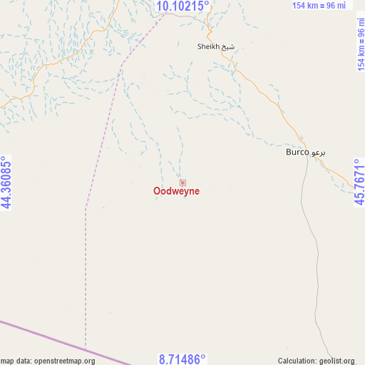
Oodweyne GPS coordinates[2]
9° 24' 33.12" North, 45° 3' 50.292" East
| Map corner | latitude | longitude |
|---|---|---|
| Upper-left | 10.10215°, | 44.36085° |
| Center: | 9.4092°, | 45.06397° |
| Lower-right: | 8.71486°, | 45.7671° |
| Map W x H: | 154.3×154.3 km | = 95.9×95.9mi |
| max Lat: | 11.96611° ⇑26.4% North |
| Oodweyne: | 9.4092° |
| min Lat: | ⇓73.6% South -1.21917° |
| min Long | Oodweyne | max Long |
| 41.83725° | 45.06397° | 51.0773° |
| W 45.3%⇐ | ⇒54.7% E |
Elevation
Elevation of Oodweyne is 1055 m = 3461 ft, and this is 765.1 m = 2510 ft above average elevation for this country.
| Max E: |
1786 m = 5860 ft | 7.5% |
| Oodweyne | 1055 m 3461 ft | |
| Avg. | 289.9 m = 951 ft | |
Min E: |
-2 m = -7 ft | 92.5% |
See also: Somalia elevation on elevation.city.
Geographical zone
Oodweyne is located in North Torrid zone (between Equator and Tropic of Cancer). Distance of Equator is 1046.2 km =650.1 mi to South.| Distance of | km | miles | from Oodweyne |
|---|---|---|---|
| North Pole | 8960.9 | 5568 | to North |
| Arctic Circle | 6355 | 3948.8 | to North |
| Tropic Cancer | 1559.7 | 969.2 | to North |
| Equator | 1046.2 | 650.1 | to South |


Nearby cities:
13 places around Oodweyne: (largest is in red/bold)
• Adado
402.6 km =250.2 mi,  154°
154°
• Baki
191.7 km =119.1 mi,  286°
286°
• Baligubadle
125.3 km =77.9 mi,  248°
248°
• Berbera
114.7 km =71.3 mi,  357°
357°
• Burao
53 km =32.9 mi,  76°
76°
• Ceek
55.9 km =34.7 mi,  144°
144°
• Ceerigaabo
285.7 km =177.5 mi,  61°
61°
• Gaalkacyo
392.4 km =243.8 mi, 138°
• Garoowe
391.9 km =243.5 mi,  106°
106°
• Hargeysa
110.8 km =68.8 mi,  278°
278°
• Laascaanood
272.6 km =169.4 mi, 112°
• Las Khorey
394.1 km =244.9 mi, 60°
• Lughaye
187.6 km =116.6 mi,  319°
319°
Sources, notices
• [Note1] Compared only with cities in Somalia existing in our database
• [Src1] Map data: © OpenStreetMap contributors (CC-BY-SA)
• [Src2] Other city data from geonames.org with taken over terms of usage.
• [Src3] Geographical zone / Annual Mean Temperature by Robert A. Rohde @ Wikipedia
