Bandarbeyla geodata
Bandarbeyla (Bari) is a populated place; located in Somalia in Africa/Mogadishu (GMT+3) time zone. With population of 13,753 people, there are 27 cities with bigger population in this country. Compared to other cities in Somalia, 75.5% of cities are located further ↓South; 96.2% of cities are located further ←West and 67.9% of cities have higher elevation than Bandarbeyla. Note1


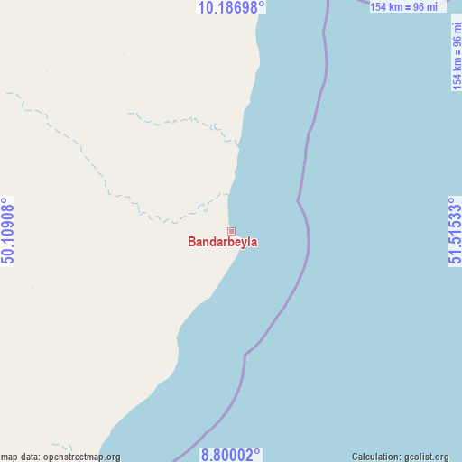
Bandarbeyla GPS coordinates[2]
9° 29' 39.12" North, 50° 48' 43.92" East
| Map corner | latitude | longitude |
|---|---|---|
| Upper-left | 10.18698°, | 50.10908° |
| Center: | 9.4942°, | 50.8122° |
| Lower-right: | 8.80002°, | 51.51533° |
| Map W x H: | 154.2×154.2 km | = 95.8×95.8mi |
| max Lat: | 11.96611° ⇑24.5% North |
| Bandarbeyla: | 9.4942° |
| min Lat: | ⇓75.5% South -1.21917° |
| min Long | Bandarbeyla | max Long |
| 41.83725° | 50.8122° | 51.0773° |
| W 96.2%⇐ | ⇒3.8% E |
Elevation
Elevation of Bandarbeyla is 29 m = 95 ft, and this is 260.9 m = 856 ft below average elevation for this country.
| Max E: |
1786 m = 5860 ft | 67.9% |
| Avg. | 289.9 m = 951 ft | |
| Bandarbeyla | 29 m = 95 ft | |
Min E: |
-2 m = -7 ft | 32.1% |
See also: Somalia elevation on elevation.city.
Geographical zone
Bandarbeyla is located in North Torrid zone (between Equator and Tropic of Cancer). Distance of Equator is 1055.7 km =656 mi to South.| Distance of | km | miles | from Bandarbeyla |
|---|---|---|---|
| North Pole | 8951.4 | 5562.1 | to North |
| Arctic Circle | 6345.5 | 3942.9 | to North |
| Tropic Cancer | 1550.3 | 963.3 | to North |
| Equator | 1055.7 | 656 | to South |


Nearby cities:
11 places around Bandarbeyla: (largest is in red/bold)
• Bargaal
201.4 km =125.1 mi,  8°
8°
• Bereeda
265.6 km =165 mi, 5°
• Bosaso
267.2 km =166 mi,  318°
318°
• Caluula
274.9 km =170.8 mi,  358°
358°
• Ceerigaabo
397.2 km =246.8 mi,  288°
288°
• Eyl
200.8 km =124.8 mi,  213°
213°
• Garoowe
283.2 km =176 mi,  244°
244°
• Iskushuban
108.5 km =67.4 mi, 324°
• Laascaanood
395.7 km =245.9 mi,  253°
253°
• Las Khorey
340.8 km =211.8 mi,  302°
302°
• Qandala
242.7 km =150.8 mi,  334°
334°
Sources, notices
• [Note1] Compared only with cities in Somalia existing in our database
• [Src1] Map data: © OpenStreetMap contributors (CC-BY-SA)
• [Src2] Other city data from geonames.org with taken over terms of usage.
• [Src3] Geographical zone / Annual Mean Temperature by Robert A. Rohde @ Wikipedia
