Garoowe geodata
Garoowe (Nugaal) is a seat of a first-order administrative division; located in Somalia in Africa/Mogadishu (GMT+3) time zone. With population of 57,300 people, there are 12 cities with bigger population in this country. Compared to other cities in Somalia, 66% of cities are located further ↓South; 83% of cities are located further ←West and 83% of cities have lower elevation than Garoowe. Note1


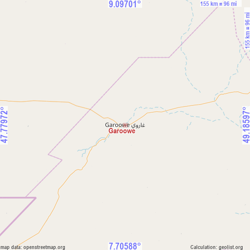
Garoowe GPS coordinates[2]
8° 24' 7.452" North, 48° 28' 58.224" East
| Map corner | latitude | longitude |
|---|---|---|
| Upper-left | 9.09701°, | 47.77972° |
| Center: | 8.40207°, | 48.48284° |
| Lower-right: | 7.70588°, | 49.18597° |
| Map W x H: | 154.7×154.7 km | = 96.1×96.1mi |
| max Lat: | 11.96611° ⇑34% North |
| Garoowe: | 8.40207° |
| min Lat: | ⇓66% South -1.21917° |
| min Long | Garoowe | max Long |
| 41.83725° | 48.48284° | 51.0773° |
| W 83%⇐ | ⇒17% E |
Elevation
Elevation of Garoowe is 465 m = 1526 ft, and this is 175.1 m = 574 ft above average elevation for this country.
| Max E: |
1786 m = 5860 ft | 17% |
| Garoowe | 465 m 1526 ft | |
| Avg. | 289.9 m = 951 ft | |
Min E: |
-2 m = -7 ft | 83% |
See also: Garoowe elevation on elevation.city.
Geographical zone
Garoowe is located in North Torrid zone (between Equator and Tropic of Cancer). Distance of Equator is 934.2 km =580.5 mi to South.| Distance of | km | miles | from Garoowe |
|---|---|---|---|
| North Pole | 9072.8 | 5637.6 | to North |
| Arctic Circle | 6467 | 4018.4 | to North |
| Tropic Cancer | 1671.7 | 1038.7 | to North |
| Equator | 934.2 | 580.5 | to South |


Nearby cities:
15 places around Garoowe: (largest is in red/bold)
• Adado
324.6 km =201.7 mi,  219°
219°
• Bandarbeyla
283.2 km =176 mi,  64°
64°
• Bosaso
329.5 km =204.7 mi,  13°
13°
• Burao
347 km =215.6 mi,  291°
291°
• Ceek
349.8 km =217.4 mi,  280°
280°
• Ceerigaabo
274.9 km =170.8 mi,  333°
333°
• Dhuusamarreeb
393.8 km =244.7 mi, 215°
• Eyl
154.1 km =95.8 mi,  107°
107°
• Gaalkacyo
215.4 km =133.8 mi,  212°
212°
• Hobyo
339.3 km =210.8 mi,  179°
179°
• Iskushuban
283.7 km =176.3 mi,  42°
42°
• Laascaanood
123.8 km =76.9 mi,  273°
273°
• Las Khorey
308.2 km =191.5 mi,  354°
354°
• Oodweyne
391.9 km =243.5 mi, 286°
• Qandala
373.7 km =232.2 mi,  24°
24°
Sources, notices
• [Note1] Compared only with cities in Somalia existing in our database
• [Src1] Map data: © OpenStreetMap contributors (CC-BY-SA)
• [Src2] Other city data from geonames.org with taken over terms of usage.
• [Src3] Geographical zone / Annual Mean Temperature by Robert A. Rohde @ Wikipedia
