Şaydnāyā geodata
Şaydnāyā (Rif-dimashq) is a seat of a third-order administrative division; located in Syria in Asia/Damascus (GMT+3) time zone. In our database, there are 87 cities with bigger population. Compared to other cities in Syria, 78.4% of cities are located further ↑North; 64.7% of cities are located further →East and 97.5% of cities have lower elevation than Şaydnāyā. Note1


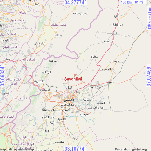
Şaydnāyā GPS coordinates[2]
33° 41' 41.028" North, 36° 22' 17.256" East
| Map corner | latitude | longitude |
|---|---|---|
| Upper-left | 34.27774°, | 35.66834° |
| Center: | 33.69473°, | 36.37146° |
| Lower-right: | 33.10774°, | 37.07459° |
| Map W x H: | 130.1×130.1 km | = 80.8×80.8mi |
| max Lat: | 37.17701° ⇑78.4% North |
| Şaydnāyā: | 33.69473° |
| min Lat: | ⇓21.6% South 32.39332° |
| min Long | Şaydnāyā | max Long |
| 35.75572° | 36.37146° | 42.14006° |
| W 35.3%⇐ | ⇒64.7% E |
Elevation
Elevation of Şaydnāyā is 1365 m = 4478 ft, and this is 835.9 m = 2742 ft above average elevation for this country.
| Max E: |
1640 m = 5381 ft | 2.5% |
| Şaydnāyā | 1365 m 4478 ft | |
| Avg. | 529.1 m = 1736 ft | |
Min E: |
4 m = 13 ft | 97.5% |
See also: Syria elevation on elevation.city.
Geographical zone
Şaydnāyā is located in North temperate zone (between Tropic of Cancer and the Arctic Circle). Distance of this Northern Tropic circle is 1140.6 km =708.7 mi to South.| Distance of | km | miles | from Şaydnāyā |
|---|---|---|---|
| North Pole | 6260.6 | 3890.2 | to North |
| Arctic Circle | 3654.7 | 2270.9 | to North |
| Tropic Cancer | 1140.6 | 708.7 | to South |
| Equator | 3746.5 | 2328 | to South |


Nearby cities:
15 places around Şaydnāyā: (largest is in red/bold)
• Al Mulayḩah
23.3 km =14.5 mi,  179°
179°
• Al Quţayfah
21.8 km =13.5 mi,  77°
77°
• An Nashābīyah
23.1 km =14.4 mi,  152°
152°
• At Tall
10.9 km =6.8 mi,  210°
210°
• Damascus
21.8 km =13.5 mi,  199°
199°
• Douma
14 km =8.7 mi,  168°
168°
• Jaramānā
23.3 km =14.5 mi,  185°
185°
• Kafr Baţnā
20.4 km =12.7 mi, 179°
• Ma‘lūlā
23.2 km =14.4 mi,  43°
43°
• Qadsayyā
21.8 km =13.5 mi,  221°
221°
• Rankūs
7 km =4.3 mi,  12°
12°
• Ḩarastā
15.1 km =9.4 mi, 182°
• ‘Assāl al Ward
19.3 km =12 mi, 11°
• ‘Ayn al Fījah
19.6 km =12.2 mi,  243°
243°
• ‘Irbīn
17.5 km =10.9 mi, 181°
Sources, notices
• [Note1] Compared only with cities in Syria existing in our database
• [Src1] Map data: © OpenStreetMap contributors (CC-BY-SA)
• [Src2] Other city data from geonames.org with taken over terms of usage.
• [Src3] Geographical zone / Annual Mean Temperature by Robert A. Rohde @ Wikipedia
