Al Ma‘baţlī geodata
Al Ma‘baţlī (Aleppo) is a seat of a third-order administrative division; located in Syria in Asia/Damascus (GMT+3) time zone. In our database, there are 87 cities with bigger population. Compared to other cities in Syria, 91.2% of cities are located further ↓South; 62.2% of cities are located further ←West and 58.7% of cities have lower elevation than Al Ma‘baţlī. Note1


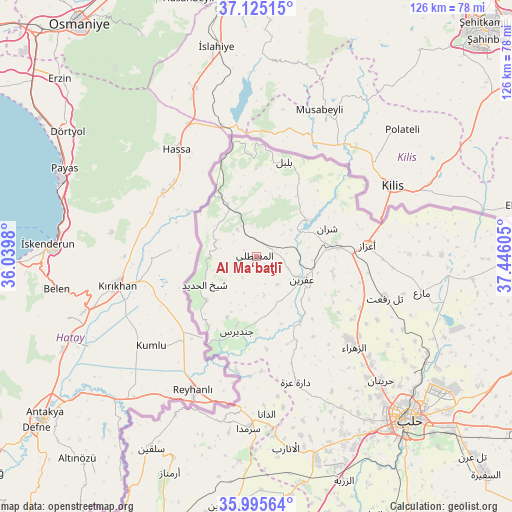
Al Ma‘baţlī GPS coordinates[2]
36° 33' 44.856" North, 36° 44' 34.512" East
| Map corner | latitude | longitude |
|---|---|---|
| Upper-left | 37.12515°, | 36.0398° |
| Center: | 36.56246°, | 36.74292° |
| Lower-right: | 35.99564°, | 37.44605° |
| Map W x H: | 125.6×125.6 km | = 78×78mi |
| max Lat: | 37.17701° ⇑8.8% North |
| Al Ma‘baţlī: | 36.56246° |
| min Lat: | ⇓91.2% South 32.39332° |
| min Long | Al Ma‘baţlī | max Long |
| 35.75572° | 36.74292° | 42.14006° |
| W 62.2%⇐ | ⇒37.8% E |
Elevation
Elevation of Al Ma‘baţlī is 523 m = 1716 ft, and this is 6.1 m = 20 ft below average elevation for this country.
| Max E: |
1640 m = 5381 ft | 41.3% |
| Avg. | 529.1 m = 1736 ft | |
| Al Ma‘baţlī | 523 m = 1716 ft | |
Min E: |
4 m = 13 ft | 58.7% |
See also: Syria elevation on elevation.city.
Geographical zone
Al Ma‘baţlī is located in North temperate zone (between Tropic of Cancer and the Arctic Circle). Distance of this Northern Tropic circle is 1459.4 km =906.8 mi to South.| Distance of | km | miles | from Al Ma‘baţlī |
|---|---|---|---|
| North Pole | 5941.7 | 3692 | to North |
| Arctic Circle | 3335.8 | 2072.8 | to North |
| Tropic Cancer | 1459.4 | 906.8 | to South |
| Equator | 4065.4 | 2526.1 | to South |


Nearby cities:
15 places around Al Ma‘baţlī: (largest is in red/bold)
• Ad Dānā
39 km =24.2 mi,  176°
176°
• Bulbul
24 km =14.9 mi,  16°
16°
• Dārat ‘Izzah
32.6 km =20.3 mi,  162°
162°
• I‘zāz
27.2 km =16.9 mi,  84°
84°
• Jindayris
19.2 km =11.9 mi,  194°
194°
• Māri‘
41.5 km =25.8 mi,  102°
102°
• Nubl
30.3 km =18.8 mi,  132°
132°
• Qenterê
1.3 km =0.8 mi,  275°
275°
• Radjun
14.4 km =8.9 mi,  330°
330°
• Sharān
18.6 km =11.6 mi,  68°
68°
• Shaykh al Ḩadīd
14.5 km =9 mi,  241°
241°
• Tall Rif‘at
33 km =20.5 mi,  107°
107°
• Şūrān
42 km =26.1 mi,  89°
89°
• Ḩuraytān
43.2 km =26.8 mi, 134°
• ‘Afrīn
12.6 km =7.8 mi,  116°
116°
Sources, notices
• [Note1] Compared only with cities in Syria existing in our database
• [Src1] Map data: © OpenStreetMap contributors (CC-BY-SA)
• [Src2] Other city data from geonames.org with taken over terms of usage.
• [Src3] Geographical zone / Annual Mean Temperature by Robert A. Rohde @ Wikipedia
