Bulbul geodata
Bulbul (Aleppo) is a seat of a third-order administrative division; located in Syria in Asia/Damascus (GMT+3) time zone. In our database, there are 87 cities with bigger population. Compared to other cities in Syria, 96.5% of cities are located further ↓South; 65.7% of cities are located further ←West and 76.7% of cities have lower elevation than Bulbul. Note1


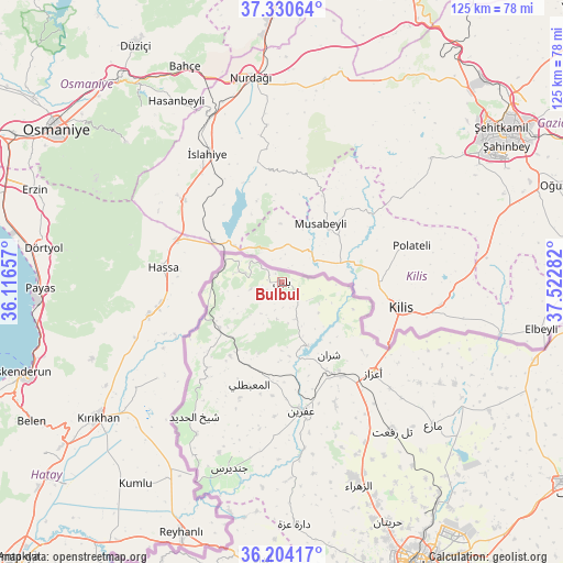
Bulbul GPS coordinates[2]
36° 46' 10.092" North, 36° 49' 10.884" East
| Map corner | latitude | longitude |
|---|---|---|
| Upper-left | 37.33064°, | 36.11657° |
| Center: | 36.76947°, | 36.81969° |
| Lower-right: | 36.20417°, | 37.52282° |
| Map W x H: | 125.3×125.3 km | = 77.9×77.9mi |
| max Lat: | 37.17701° ⇑3.5% North |
| Bulbul: | 36.76947° |
| min Lat: | ⇓96.5% South 32.39332° |
| min Long | Bulbul | max Long |
| 35.75572° | 36.81969° | 42.14006° |
| W 65.7%⇐ | ⇒34.3% E |
Elevation
Elevation of Bulbul is 690 m = 2264 ft, and this is 160.9 m = 528 ft above average elevation for this country.
| Max E: |
1640 m = 5381 ft | 23.3% |
| Bulbul | 690 m 2264 ft | |
| Avg. | 529.1 m = 1736 ft | |
Min E: |
4 m = 13 ft | 76.7% |
See also: Syria elevation on elevation.city.
Geographical zone
Bulbul is located in North temperate zone (between Tropic of Cancer and the Arctic Circle). Distance of this Northern Tropic circle is 1482.5 km =921.2 mi to South.| Distance of | km | miles | from Bulbul |
|---|---|---|---|
| North Pole | 5918.7 | 3677.7 | to North |
| Arctic Circle | 3312.8 | 2058.5 | to North |
| Tropic Cancer | 1482.5 | 921.2 | to South |
| Equator | 4088.4 | 2540.4 | to South |


Nearby cities:
15 places around Bulbul: (largest is in red/bold)
• Akhtarīn
54.3 km =33.7 mi,  122°
122°
• Al Ma‘baţlī
24 km =14.9 mi,  196°
196°
• Dārat ‘Izzah
54.2 km =33.7 mi,  176°
176°
• I‘zāz
28.7 km =17.8 mi,  135°
135°
• Jindayris
43.2 km =26.8 mi, 195°
• Māri‘
46.4 km =28.8 mi,  133°
133°
• Nubl
46.1 km =28.6 mi,  160°
160°
• Qenterê
24.3 km =15.1 mi, 199°
• Radjun
17.3 km =10.7 mi,  233°
233°
• Sharān
19.3 km =12 mi,  147°
147°
• Shaykh al Ḩadīd
35.8 km =22.2 mi,  213°
213°
• Tall Rif‘at
41.2 km =25.6 mi, 143°
• Şūrān
41.7 km =25.9 mi, 122°
• Ḩuraytān
58.5 km =36.4 mi, 156°
• ‘Afrīn
29 km =18 mi,  171°
171°
Sources, notices
• [Note1] Compared only with cities in Syria existing in our database
• [Src1] Map data: © OpenStreetMap contributors (CC-BY-SA)
• [Src2] Other city data from geonames.org with taken over terms of usage.
• [Src3] Geographical zone / Annual Mean Temperature by Robert A. Rohde @ Wikipedia
