Māri‘ geodata
Māri‘ (Aleppo) is a seat of a third-order administrative division; located in Syria in Asia/Damascus (GMT+3) time zone. In our database, there are 87 cities with bigger population. Compared to other cities in Syria, 89% of cities are located further ↓South; 73.9% of cities are located further ←West and 54.4% of cities have higher elevation than Māri‘. Note1


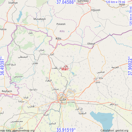
Māri‘ GPS coordinates[2]
36° 28' 57.324" North, 37° 11' 49.524" East
| Map corner | latitude | longitude |
|---|---|---|
| Upper-left | 37.04586°, | 36.49397° |
| Center: | 36.48259°, | 37.19709° |
| Lower-right: | 35.91519°, | 37.90022° |
| Map W x H: | 125.7×125.7 km | = 78.1×78.1mi |
| max Lat: | 37.17701° ⇑11% North |
| Māri‘: | 36.48259° |
| min Lat: | ⇓89% South 32.39332° |
| min Long | Māri‘ | max Long |
| 35.75572° | 37.19709° | 42.14006° |
| W 73.9%⇐ | ⇒26.1% E |
Elevation
Elevation of Māri‘ is 450 m = 1476 ft, and this is 79.1 m = 260 ft below average elevation for this country.
| Max E: |
1640 m = 5381 ft | 54.4% |
| Avg. | 529.1 m = 1736 ft | |
| Māri‘ | 450 m = 1476 ft | |
Min E: |
4 m = 13 ft | 45.6% |
See also: Syria elevation on elevation.city.
Geographical zone
Māri‘ is located in North temperate zone (between Tropic of Cancer and the Arctic Circle). Distance of this Northern Tropic circle is 1450.6 km =901.4 mi to South.| Distance of | km | miles | from Māri‘ |
|---|---|---|---|
| North Pole | 5950.6 | 3697.5 | to North |
| Arctic Circle | 3344.7 | 2078.3 | to North |
| Tropic Cancer | 1450.6 | 901.4 | to South |
| Equator | 4056.5 | 2520.6 | to South |


Nearby cities:
15 places around Māri‘: (largest is in red/bold)
• Akhtarīn
12.8 km =8 mi,  75°
75°
• Al Bāb
31.1 km =19.3 mi,  113°
113°
• Al Ma‘baţlī
41.5 km =25.8 mi,  282°
282°
• Aleppo
31.4 km =19.5 mi,  185°
185°
• Dārat ‘Izzah
38.1 km =23.7 mi,  234°
234°
• I‘zāz
17.8 km =11.1 mi,  310°
310°
• Kafr Şaghīr
21.8 km =13.5 mi,  166°
166°
• Nubl
21.6 km =13.4 mi,  237°
237°
• Sharān
28 km =17.4 mi,  303°
303°
• Tall Rif‘at
9.2 km =5.7 mi,  262°
262°
• Tchoban Bey
26.6 km =16.5 mi,  57°
57°
• Tādif
33.4 km =20.8 mi,  116°
116°
• Şūrān
9.4 km =5.8 mi,  8°
8°
• Ḩuraytān
23.8 km =14.8 mi,  204°
204°
• ‘Afrīn
29.5 km =18.3 mi, 276°
Sources, notices
• [Note1] Compared only with cities in Syria existing in our database
• [Src1] Map data: © OpenStreetMap contributors (CC-BY-SA)
• [Src2] Other city data from geonames.org with taken over terms of usage.
• [Src3] Geographical zone / Annual Mean Temperature by Robert A. Rohde @ Wikipedia
