Sharān geodata
Sharān (Aleppo) is a seat of a third-order administrative division; located in Syria in Asia/Damascus (GMT+3) time zone. In our database, there are 87 cities with bigger population. Compared to other cities in Syria, 93.6% of cities are located further ↓South; 68.6% of cities are located further ←West and 54.1% of cities have lower elevation than Sharān. Note1


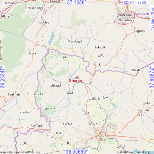
Sharān GPS coordinates[2]
36° 37' 24.096" North, 36° 56' 11.724" East
| Map corner | latitude | longitude |
|---|---|---|
| Upper-left | 37.1856°, | 36.23347° |
| Center: | 36.62336°, | 36.93659° |
| Lower-right: | 36.05699°, | 37.63972° |
| Map W x H: | 125.5×125.5 km | = 78×78mi |
| max Lat: | 37.17701° ⇑6.4% North |
| Sharān: | 36.62336° |
| min Lat: | ⇓93.6% South 32.39332° |
| min Long | Sharān | max Long |
| 35.75572° | 36.93659° | 42.14006° |
| W 68.6%⇐ | ⇒31.4% E |
Elevation
Elevation of Sharān is 490 m = 1608 ft, and this is 39.1 m = 128 ft below average elevation for this country.
| Max E: |
1640 m = 5381 ft | 45.9% |
| Avg. | 529.1 m = 1736 ft | |
| Sharān | 490 m = 1608 ft | |
Min E: |
4 m = 13 ft | 54.1% |
See also: Syria elevation on elevation.city.
Geographical zone
Sharān is located in North temperate zone (between Tropic of Cancer and the Arctic Circle). Distance of this Northern Tropic circle is 1466.2 km =911.1 mi to South.| Distance of | km | miles | from Sharān |
|---|---|---|---|
| North Pole | 5934.9 | 3687.8 | to North |
| Arctic Circle | 3329 | 2068.5 | to North |
| Tropic Cancer | 1466.2 | 911.1 | to South |
| Equator | 4072.1 | 2530.3 | to South |


Nearby cities:
15 places around Sharān: (largest is in red/bold)
• Akhtarīn
37.8 km =23.5 mi,  109°
109°
• Al Ma‘baţlī
18.6 km =11.6 mi,  248°
248°
• Bulbul
19.3 km =12 mi,  327°
327°
• Dārat ‘Izzah
38.6 km =24 mi,  191°
191°
• I‘zāz
10.6 km =6.6 mi, 112°
• Jindayris
33.7 km =20.9 mi,  221°
221°
• Māri‘
28 km =17.4 mi,  123°
123°
• Nubl
27.7 km =17.2 mi,  169°
169°
• Qenterê
19.7 km =12.2 mi, 250°
• Radjun
25 km =15.5 mi,  283°
283°
• Shaykh al Ḩadīd
33.1 km =20.6 mi, 245°
• Tall Rif‘at
21.9 km =13.6 mi,  139°
139°
• Şūrān
25.5 km =15.8 mi,  104°
104°
• Ḩuraytān
39.5 km =24.5 mi,  160°
160°
• ‘Afrīn
13.8 km =8.6 mi,  205°
205°
Sources, notices
• [Note1] Compared only with cities in Syria existing in our database
• [Src1] Map data: © OpenStreetMap contributors (CC-BY-SA)
• [Src2] Other city data from geonames.org with taken over terms of usage.
• [Src3] Geographical zone / Annual Mean Temperature by Robert A. Rohde @ Wikipedia
