Ḩadīdah geodata
Ḩadīdah (Homs) is a seat of a third-order administrative division; located in Syria in Asia/Damascus (GMT+3) time zone. In our database, there are 87 cities with bigger population. Compared to other cities in Syria, 68.9% of cities are located further ↑North; 61.5% of cities are located further →East and 50.5% of cities have higher elevation than Ḩadīdah. Note1


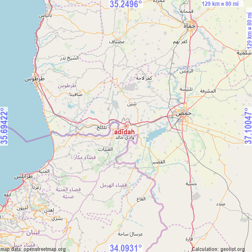
Ḩadīdah GPS coordinates[2]
34° 40' 24.132" North, 36° 23' 50.424" East
| Map corner | latitude | longitude |
|---|---|---|
| Upper-left | 35.2496°, | 35.69422° |
| Center: | 34.67337°, | 36.39734° |
| Lower-right: | 34.0931°, | 37.10047° |
| Map W x H: | 128.6×128.6 km | = 79.9×79.9mi |
| max Lat: | 37.17701° ⇑68.9% North |
| Ḩadīdah: | 34.67337° |
| min Lat: | ⇓31.1% South 32.39332° |
| min Long | Ḩadīdah | max Long |
| 35.75572° | 36.39734° | 42.14006° |
| W 38.5%⇐ | ⇒61.5% E |
Elevation
Elevation of Ḩadīdah is 468 m = 1535 ft, and this is 61.1 m = 200 ft below average elevation for this country.
| Max E: |
1640 m = 5381 ft | 50.5% |
| Avg. | 529.1 m = 1736 ft | |
| Ḩadīdah | 468 m = 1535 ft | |
Min E: |
4 m = 13 ft | 49.5% |
See also: Syria elevation on elevation.city.
Geographical zone
Ḩadīdah is located in North temperate zone (between Tropic of Cancer and the Arctic Circle). Distance of this Northern Tropic circle is 1249.4 km =776.3 mi to South.| Distance of | km | miles | from Ḩadīdah |
|---|---|---|---|
| North Pole | 6151.7 | 3822.5 | to North |
| Arctic Circle | 3545.9 | 2203.3 | to North |
| Tropic Cancer | 1249.4 | 776.3 | to South |
| Equator | 3855.3 | 2395.6 | to South |


Nearby cities:
15 places around Ḩadīdah: (largest is in red/bold)
• Al Bāriqīyah
23.2 km =14.4 mi,  318°
318°
• Al Karīmah
29.4 km =18.3 mi,  269°
269°
• Al Qabw
19.6 km =12.2 mi,  15°
15°
• Al Quşayr
24.9 km =15.5 mi,  137°
137°
• Al Ḩawāsh
11.9 km =7.4 mi, 324°
• An Nāşirah
16.3 km =10.1 mi, 321°
• As Sīsnīyah
26.1 km =16.2 mi,  297°
297°
• Kafr Lāhā
26.2 km =16.3 mi, 20°
• Khirbat Tīn Nūr
14.9 km =9.3 mi,  77°
77°
• Mashtá al Ḩulw
26.1 km =16.2 mi,  329°
329°
• Sabbah
29.4 km =18.3 mi, 330°
• Shīn
11.9 km =7.4 mi,  11°
11°
• Talldaww
25.4 km =15.8 mi,  27°
27°
• Tallkalakh
12.6 km =7.8 mi, 267°
• ‘Awaj
26 km =16.2 mi,  1°
1°
Sources, notices
• [Note1] Compared only with cities in Syria existing in our database
• [Src1] Map data: © OpenStreetMap contributors (CC-BY-SA)
• [Src2] Other city data from geonames.org with taken over terms of usage.
• [Src3] Geographical zone / Annual Mean Temperature by Robert A. Rohde @ Wikipedia
