Talldaww geodata
Talldaww (Homs) is a seat of a third-order administrative division; located in Syria in Asia/Damascus (GMT+3) time zone. In our database, there are 87 cities with bigger population. Compared to other cities in Syria, 60.8% of cities are located further ↑North; 54.1% of cities are located further →East and 65.7% of cities have higher elevation than Talldaww. Note1


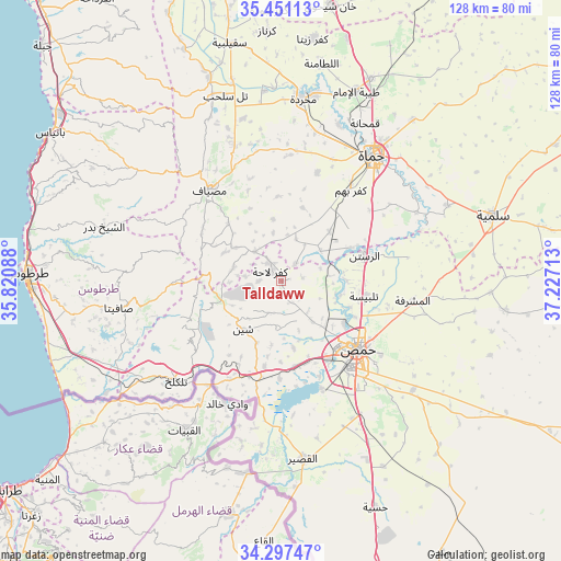
Talldaww GPS coordinates[2]
34° 52' 34.752" North, 36° 31' 26.4" East
| Map corner | latitude | longitude |
|---|---|---|
| Upper-left | 35.45113°, | 35.82088° |
| Center: | 34.87632°, | 36.524° |
| Lower-right: | 34.29747°, | 37.22713° |
| Map W x H: | 128.3×128.3 km | = 79.7×79.7mi |
| max Lat: | 37.17701° ⇑60.8% North |
| Talldaww: | 34.87632° |
| min Lat: | ⇓39.2% South 32.39332° |
| min Long | Talldaww | max Long |
| 35.75572° | 36.524° | 42.14006° |
| W 45.9%⇐ | ⇒54.1% E |
Elevation
Elevation of Talldaww is 375 m = 1230 ft, and this is 154.1 m = 506 ft below average elevation for this country.
| Max E: |
1640 m = 5381 ft | 65.7% |
| Avg. | 529.1 m = 1736 ft | |
| Talldaww | 375 m = 1230 ft | |
Min E: |
4 m = 13 ft | 34.3% |
See also: Syria elevation on elevation.city.
Geographical zone
Talldaww is located in North temperate zone (between Tropic of Cancer and the Arctic Circle). Distance of this Northern Tropic circle is 1272 km =790.4 mi to South.| Distance of | km | miles | from Talldaww |
|---|---|---|---|
| North Pole | 6129.2 | 3808.5 | to North |
| Arctic Circle | 3523.3 | 2189.3 | to North |
| Tropic Cancer | 1272 | 790.4 | to South |
| Equator | 3877.9 | 2409.6 | to South |


Nearby cities:
15 places around Talldaww: (largest is in red/bold)
• Al Ghanţū
16.8 km =10.4 mi,  111°
111°
• Al Qabw
7.3 km =4.5 mi,  239°
239°
• Al Ḩawāsh
22.6 km =14 mi, 235°
• An Nāşirah
23.9 km =14.9 mi,  245°
245°
• Ar Rastan
19.8 km =12.3 mi,  73°
73°
• Homs
24.7 km =15.3 mi,  132°
132°
• Kafr Lāhā
3.3 km =2.1 mi,  308°
308°
• Khirbat Tīn Nūr
19.7 km =12.2 mi,  171°
171°
• Mashtá al Ḩulw
24.9 km =15.5 mi,  269°
269°
• Shīn
14.2 km =8.8 mi,  220°
220°
• Tallbīsah
19.3 km =12 mi,  101°
101°
• Ḩadīdah
25.4 km =15.8 mi,  207°
207°
• Ḩarbinafsah
11.3 km =7 mi,  52°
52°
• ‘Awaj
11.4 km =7.1 mi,  287°
287°
• ‘Ayn Ḩalāqīm
19.7 km =12.2 mi, 291°
Sources, notices
• [Note1] Compared only with cities in Syria existing in our database
• [Src1] Map data: © OpenStreetMap contributors (CC-BY-SA)
• [Src2] Other city data from geonames.org with taken over terms of usage.
• [Src3] Geographical zone / Annual Mean Temperature by Robert A. Rohde @ Wikipedia
