Shaqqā geodata
Shaqqā (As-Suwayda) is a seat of a third-order administrative division; located in Syria in Asia/Damascus (GMT+3) time zone. In our database, there are 87 cities with bigger population. Compared to other cities in Syria, 91.2% of cities are located further ↑North; 57.6% of cities are located further ←West and 95.4% of cities have lower elevation than Shaqqā. Note1


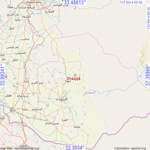
Shaqqā GPS coordinates[2]
32° 53' 51.828" North, 36° 41' 47.508" East
| Map corner | latitude | longitude |
|---|---|---|
| Upper-left | 33.48613°, | 35.99341° |
| Center: | 32.89773°, | 36.69653° |
| Lower-right: | 32.3054°, | 37.39966° |
| Map W x H: | 131.3×131.3 km | = 81.6×81.6mi |
| max Lat: | 37.17701° ⇑91.2% North |
| Shaqqā: | 32.89773° |
| min Lat: | ⇓8.8% South 32.39332° |
| min Long | Shaqqā | max Long |
| 35.75572° | 36.69653° | 42.14006° |
| W 57.6%⇐ | ⇒42.4% E |
Elevation
Elevation of Shaqqā is 1193 m = 3914 ft, and this is 663.9 m = 2178 ft above average elevation for this country.
| Max E: |
1640 m = 5381 ft | 4.6% |
| Shaqqā | 1193 m 3914 ft | |
| Avg. | 529.1 m = 1736 ft | |
Min E: |
4 m = 13 ft | 95.4% |
See also: Syria elevation on elevation.city.
Geographical zone
Shaqqā is located in North temperate zone (between Tropic of Cancer and the Arctic Circle). Distance of this Northern Tropic circle is 1052 km =653.7 mi to South.| Distance of | km | miles | from Shaqqā |
|---|---|---|---|
| North Pole | 6349.2 | 3945.2 | to North |
| Arctic Circle | 3743.3 | 2326 | to North |
| Tropic Cancer | 1052 | 653.7 | to South |
| Equator | 3657.9 | 2272.9 | to South |


Nearby cities:
15 places around Shaqqā: (largest is in red/bold)
• Al Mazra‘ah
24.1 km =15 mi,  238°
238°
• Al Musayfirah
44.6 km =27.7 mi,  228°
228°
• Al Mushannaf
19.1 km =11.9 mi,  157°
157°
• Al Qurayyā
40.5 km =25.2 mi,  193°
193°
• Al Ḩarāk
39.7 km =24.7 mi,  245°
245°
• As-Suwayda
24.1 km =15 mi,  209°
209°
• Aş Şūrah aş Şaghīrah
18.8 km =11.7 mi,  322°
322°
• Buşrá ash Shām
46.5 km =28.9 mi, 205°
• Izra‘
41.4 km =25.7 mi,  265°
265°
• Malaḩ
45.9 km =28.5 mi, 160°
• Mismīyah
38.2 km =23.7 mi,  312°
312°
• Shahbā
7.9 km =4.9 mi, 233°
• Şalkhad
45.1 km =28 mi,  178°
178°
• Şalākhid
11.9 km =7.4 mi,  256°
256°
• ‘Arīqah
19.9 km =12.4 mi, 267°
Sources, notices
• [Note1] Compared only with cities in Syria existing in our database
• [Src1] Map data: © OpenStreetMap contributors (CC-BY-SA)
• [Src2] Other city data from geonames.org with taken over terms of usage.
• [Src3] Geographical zone / Annual Mean Temperature by Robert A. Rohde @ Wikipedia
