Aş Şūrah aş Şaghīrah geodata
Aş Şūrah aş Şaghīrah (As-Suwayda) is a seat of a third-order administrative division; located in Syria in Asia/Damascus (GMT+3) time zone. In our database, there are 87 cities with bigger population. Compared to other cities in Syria, 90.1% of cities are located further ↑North; 50.5% of cities are located further →East and 80.9% of cities have lower elevation than Aş Şūrah aş Şaghīrah. Note1
Current local time in Aş Şūrah aş Şaghīrah:
01:47 PM, WednesdayDifference from your time zone: hours


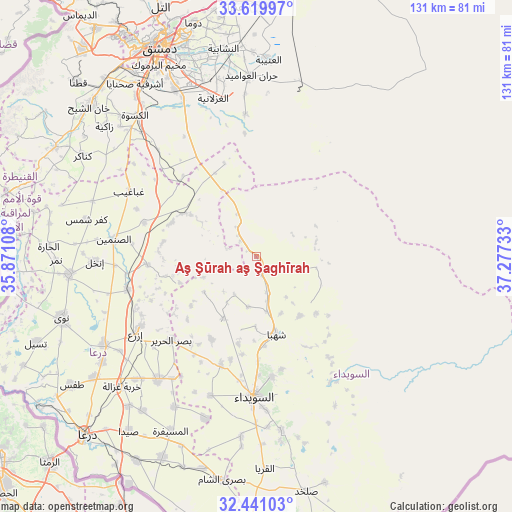
Aş Şūrah aş Şaghīrah GPS coordinates[2]
33° 1' 56.892" North, 36° 34' 27.12" East
| Map corner | latitude | longitude |
|---|---|---|
| Upper-left | 33.61997°, | 35.87108° |
| Center: | 33.03247°, | 36.5742° |
| Lower-right: | 32.44103°, | 37.27733° |
| Map W x H: | 131.1×131.1 km | = 81.5×81.5mi |
| max Lat: | 37.17701° ⇑90.1% North |
| Aş Şūrah aş Şaghīrah: | 33.03247° |
| min Lat: | ⇓9.9% South 32.39332° |
| min Long | Aş Şūrah aş | max Long |
| 35.75572° | 36.5742° | 42.14006° |
| W 49.5%⇐ | ⇒50.5% E |
Elevation
Elevation of Aş Şūrah aş Şaghīrah is 737 m = 2418 ft, and this is 207.9 m = 682 ft above average elevation for this country.
| Max E: |
1640 m = 5381 ft | 19.1% |
| Aş Şūrah aş Şaghīrah | 737 m 2418 ft | |
| Avg. | 529.1 m = 1736 ft | |
Min E: |
4 m = 13 ft | 80.9% |
See also: Syria elevation on elevation.city.
Geographical zone
Aş Şūrah aş Şaghīrah is located in North temperate zone (between Tropic of Cancer and the Arctic Circle). Distance of this Northern Tropic circle is 1066.9 km =662.9 mi to South.| Distance of | km | miles | from Aş Şūrah aş Şaghīrah |
|---|---|---|---|
| North Pole | 6334.2 | 3935.9 | to North |
| Arctic Circle | 3728.3 | 2316.7 | to North |
| Tropic Cancer | 1066.9 | 662.9 | to South |
| Equator | 3672.9 | 2282.2 | to South |


Nearby cities:
15 places around Aş Şūrah aş Şaghīrah: (largest is in red/bold)
• Al Ghizlānīyah
42 km =26.1 mi,  344°
344°
• Al Mazra‘ah
29.1 km =18.1 mi,  198°
198°
• Al Mushannaf
37.6 km =23.4 mi,  150°
150°
• Al Ḩarāk
40 km =24.9 mi,  218°
218°
• As-Suwayda
36 km =22.4 mi,  180°
180°
• Ash Shaykh Miskīn
44.8 km =27.8 mi,  239°
239°
• Aş Şanamayn
36.7 km =22.8 mi,  276°
276°
• Ghabāghib
36.5 km =22.7 mi,  297°
297°
• Inkhil
41.6 km =25.8 mi,  267°
267°
• Izra‘
34.8 km =21.6 mi, 238°
• Mismīyah
19.9 km =12.4 mi, 302°
• Shahbā
20.4 km =12.7 mi,  165°
165°
• Shaqqā
18.8 km =11.7 mi,  142°
142°
• Şalākhid
17.8 km =11.1 mi, 180°
• ‘Arīqah
18 km =11.2 mi,  208°
208°
Sources, notices
• [Note1] Compared only with cities in Syria existing in our database
• [Src1] Map data: © OpenStreetMap contributors (CC-BY-SA)
• [Src2] Other city data from geonames.org with taken over terms of usage.
• [Src3] Geographical zone / Annual Mean Temperature by Robert A. Rohde @ Wikipedia
