Khlong Lan geodata
Khlong Lan (Kamphaeng Phet) is a seat of a second-order administrative division; located in Thailand in Asia/Bangkok (GMT+7) time zone. In our database, there are 331 cities with bigger population. Compared to other cities in Thailand, 68.5% of cities are located further ↓South; 87.7% of cities are located further →East and 64.1% of cities have lower elevation than Khlong Lan. Note1


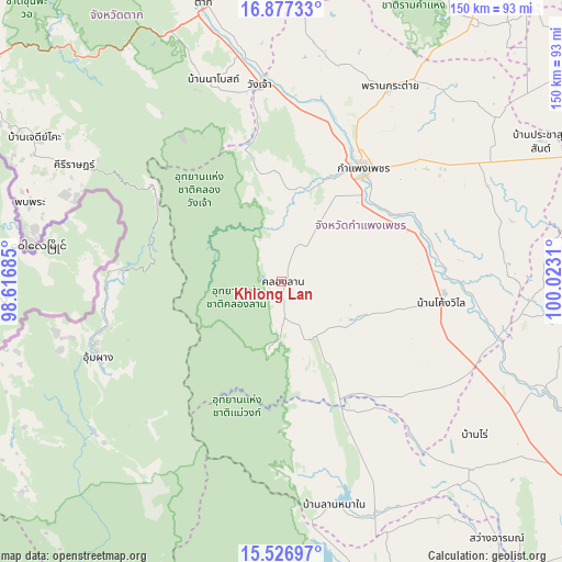
Khlong Lan GPS coordinates[2]
16° 12' 11.916" North, 99° 19' 11.892" East
| Map corner | latitude | longitude |
|---|---|---|
| Upper-left | 16.87733°, | 98.61685° |
| Center: | 16.20331°, | 99.31997° |
| Lower-right: | 15.52697°, | 100.0231° |
| Map W x H: | 150.1×150.1 km | = 93.3×93.3mi |
| max Lat: | 20.43353° ⇑31.5% North |
| Khlong Lan: | 16.20331° |
| min Lat: | ⇓68.5% South 5.77434° |
| min Long | Khlong Lan | max Long |
| 97.93288° | 99.31997° | 105.49506° |
| W 12.3%⇐ | ⇒87.7% E |
Elevation
Elevation of Khlong Lan is 158 m = 518 ft, and this is 32.5 m = 107 ft above average elevation for this country.
| Max E: |
1011 m = 3317 ft | 35.9% |
| Khlong Lan | 158 m 518 ft | |
| Avg. | 125.5 m = 412 ft | |
Min E: |
1 m = 3 ft | 64.1% |
See also: Thailand elevation on elevation.city.
Geographical zone
Khlong Lan is located in North Torrid zone (between Equator and Tropic of Cancer). Distance of this Northern Tropic circle is 804.3 km =499.8 mi to North.| Distance of | km | miles | from Khlong Lan |
|---|---|---|---|
| North Pole | 8205.4 | 5098.6 | to North |
| Arctic Circle | 5599.5 | 3479.4 | to North |
| Tropic Cancer | 804.3 | 499.8 | to North |
| Equator | 1801.6 | 1119.5 | to South |


Nearby cities:
15 places around Khlong Lan: (largest is in red/bold)
• Bueng Samakkhi
70 km =43.5 mi,  91°
91°
• Chum Ta Bong
68.2 km =42.4 mi,  158°
158°
• Kamphaeng Phet
37.9 km =23.5 mi,  34°
34°
• Khanu Woralaksaburi
59.9 km =37.2 mi,  105°
105°
• Khlong Khlung
42.6 km =26.5 mi, 88°
• Kosamphi Nakhon
47.7 km =29.6 mi,  3°
3°
• Mae Poen
62.7 km =39 mi,  165°
165°
• Mae Wong
51.5 km =32 mi, 155°
• Pang Sila Thong
21.6 km =13.4 mi,  123°
123°
• Phop Phra
70.2 km =43.6 mi,  286°
286°
• Phran Kratai
58.8 km =36.5 mi, 29°
• Sai Ngam
67.4 km =41.9 mi,  64°
64°
• Thung Sai
56.1 km =34.9 mi,  77°
77°
• Umphang
53.1 km =33 mi,  246°
246°
• Wang Chao
52.7 km =32.7 mi,  354°
354°
Sources, notices
• [Note1] Compared only with cities in Thailand existing in our database
• [Src1] Map data: © OpenStreetMap contributors (CC-BY-SA)
• [Src2] Other city data from geonames.org with taken over terms of usage.
• [Src3] Geographical zone / Annual Mean Temperature by Robert A. Rohde @ Wikipedia
