Khanu Woralaksaburi geodata
Khanu Woralaksaburi (Kamphaeng Phet) is a seat of a second-order administrative division; located in Thailand in Asia/Bangkok (GMT+7) time zone. With population of 21,889 people, there are 146 cities with bigger population in this country. Compared to other cities in Thailand, 66.6% of cities are located further ↓South; 77.3% of cities are located further →East and 56.8% of cities have higher elevation than Khanu Woralaksaburi. Note1


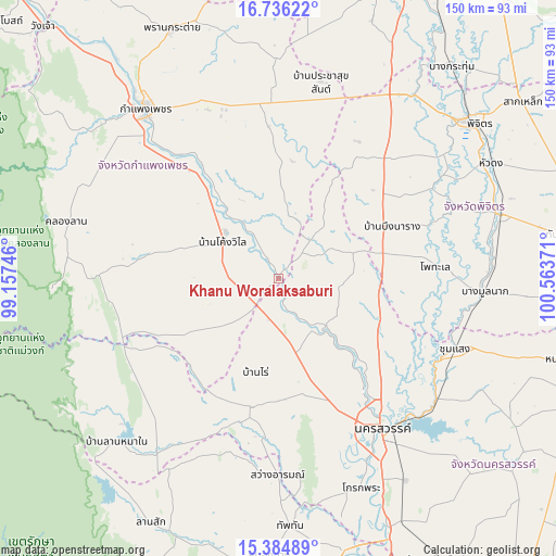
Khanu Woralaksaburi GPS coordinates[2]
16° 3' 42.12" North, 99° 51' 38.088" East
| Map corner | latitude | longitude |
|---|---|---|
| Upper-left | 16.73622°, | 99.15746° |
| Center: | 16.0617°, | 99.86058° |
| Lower-right: | 15.38489°, | 100.56371° |
| Map W x H: | 150.3×150.3 km | = 93.4×93.4mi |
| max Lat: | 20.43353° ⇑33.4% North |
| Khanu Woralaksaburi: | 16.0617° |
| min Lat: | ⇓66.6% South 5.77434° |
| min Long | Khanu Woralaksa | max Long |
| 97.93288° | 99.86058° | 105.49506° |
| W 22.7%⇐ | ⇒77.3% E |
Elevation
Elevation of Khanu Woralaksaburi is 52 m = 171 ft, and this is 73.5 m = 241 ft below average elevation for this country.
| Max E: |
1011 m = 3317 ft | 56.8% |
| Avg. | 125.5 m = 412 ft | |
| Khanu Woralaksaburi | 52 m = 171 ft | |
Min E: |
1 m = 3 ft | 43.2% |
See also: Thailand elevation on elevation.city.
Geographical zone
Khanu Woralaksaburi is located in North Torrid zone (between Equator and Tropic of Cancer). Distance of this Northern Tropic circle is 820 km =509.5 mi to North.| Distance of | km | miles | from Khanu Woralaksaburi |
|---|---|---|---|
| North Pole | 8221.2 | 5108.4 | to North |
| Arctic Circle | 5615.3 | 3489.2 | to North |
| Tropic Cancer | 820 | 509.5 | to North |
| Equator | 1785.9 | 1109.7 | to South |


Nearby cities:
15 places around Khanu Woralaksaburi: (largest is in red/bold)
• Bang Mun Nak
55.5 km =34.5 mi,  93°
93°
• Banphot Phisai
19.1 km =11.9 mi,  137°
137°
• Bueng Na Rang
30.8 km =19.1 mi,  66°
66°
• Bueng Samakkhi
18.6 km =11.6 mi,  41°
41°
• Chumsaeng
51.4 km =31.9 mi,  111°
111°
• Kao Liao
33.1 km =20.6 mi, 135°
• Khlong Khlung
22.9 km =14.2 mi,  318°
318°
• Lat Yao
35.4 km =22 mi,  192°
192°
• Mae Wong
48 km =29.8 mi,  229°
229°
• Nakhon Sawan
49.5 km =30.8 mi, 143°
• Pang Sila Thong
39.9 km =24.8 mi,  275°
275°
• Pho Thale
42.9 km =26.7 mi, 85°
• Sai Ngam
45.3 km =28.1 mi,  3°
3°
• Sawang Arom
53.1 km =33 mi,  179°
179°
• Thung Sai
28.3 km =17.6 mi,  353°
353°
Sources, notices
• [Note1] Compared only with cities in Thailand existing in our database
• [Src1] Map data: © OpenStreetMap contributors (CC-BY-SA)
• [Src2] Other city data from geonames.org with taken over terms of usage.
• [Src3] Geographical zone / Annual Mean Temperature by Robert A. Rohde @ Wikipedia
