Mae Ai geodata
Mae Ai (Chiang Mai) is a seat of a second-order administrative division; located in Thailand in Asia/Bangkok (GMT+7) time zone. In our database, there are 331 cities with bigger population. Compared to other cities in Thailand, 99.2% of cities are located further ↓South; 88% of cities are located further →East and 97.5% of cities have lower elevation than Mae Ai. Note1


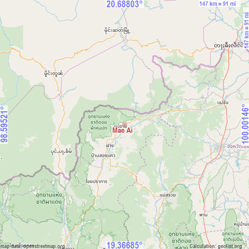
Mae Ai GPS coordinates[2]
20° 1' 43.788" North, 99° 17' 53.988" East
| Map corner | latitude | longitude |
|---|---|---|
| Upper-left | 20.68803°, | 98.59521° |
| Center: | 20.02883°, | 99.29833° |
| Lower-right: | 19.36685°, | 100.00146° |
| Map W x H: | 146.9×146.9 km | = 91.3×91.3mi |
| max Lat: | 20.43353° ⇑0.8% North |
| Mae Ai: | 20.02883° |
| min Lat: | ⇓99.2% South 5.77434° |
| min Long | Mae Ai | max Long |
| 97.93288° | 99.29833° | 105.49506° |
| W 12%⇐ | ⇒88% E |
Elevation
Elevation of Mae Ai is 467 m = 1532 ft, and this is 341.5 m = 1120 ft above average elevation for this country.
| Max E: |
1011 m = 3317 ft | 2.5% |
| Mae Ai | 467 m 1532 ft | |
| Avg. | 125.5 m = 412 ft | |
Min E: |
1 m = 3 ft | 97.5% |
See also: Thailand elevation on elevation.city.
Geographical zone
Mae Ai is located in North Torrid zone (between Equator and Tropic of Cancer). Distance of this Northern Tropic circle is 378.9 km =235.4 mi to North.| Distance of | km | miles | from Mae Ai |
|---|---|---|---|
| North Pole | 7780.1 | 4834.3 | to North |
| Arctic Circle | 5174.2 | 3215.1 | to North |
| Tropic Cancer | 378.9 | 235.4 | to North |
| Equator | 2227 | 1383.8 | to South |


Nearby cities:
15 places around Mae Ai: (largest is in red/bold)
• Ban Ho Mae Salong
38.2 km =23.7 mi,  66°
66°
• Chai Prakan
37 km =23 mi,  206°
206°
• Chiang Dao
81.6 km =50.7 mi, 205°
• Chiang Rai
57.4 km =35.7 mi,  103°
103°
• Fang
15.2 km =9.4 mi,  215°
215°
• Mae Chan
59.3 km =36.8 mi,  77°
77°
• Mae Fa Luang
58.5 km =36.4 mi,  63°
63°
• Mae Lao
49.7 km =30.9 mi,  122°
122°
• Mae Sai
75.2 km =46.7 mi,  53°
53°
• Mae Suai
48.7 km =30.3 mi,  148°
148°
• Phan
70.2 km =43.6 mi,  138°
138°
• Phrao
74.4 km =46.2 mi,  187°
187°
• Wiang Chai
68.3 km =42.4 mi, 103°
• Wiang Chiang Rung
79.2 km =49.2 mi,  91°
91°
• Wiang Pa Pao
78.8 km =49 mi,  163°
163°
Sources, notices
• [Note1] Compared only with cities in Thailand existing in our database
• [Src1] Map data: © OpenStreetMap contributors (CC-BY-SA)
• [Src2] Other city data from geonames.org with taken over terms of usage.
• [Src3] Geographical zone / Annual Mean Temperature by Robert A. Rohde @ Wikipedia
