Fang geodata
Fang (Chiang Mai) is a seat of a second-order administrative division; located in Thailand in Asia/Bangkok (GMT+7) time zone. With population of 7,635 people, there are 296 cities with bigger population in this country. Compared to other cities in Thailand, 99% of cities are located further ↓South; 88.8% of cities are located further →East and 97.6% of cities have lower elevation than Fang. Note1


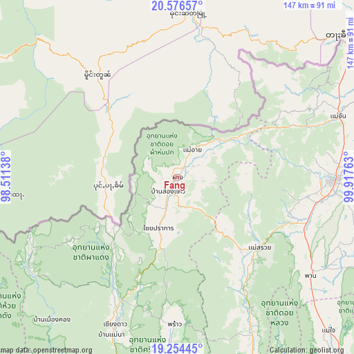
Fang GPS coordinates[2]
19° 55' 0.804" North, 99° 12' 52.2" East
| Map corner | latitude | longitude |
|---|---|---|
| Upper-left | 20.57657°, | 98.51138° |
| Center: | 19.91689°, | 99.2145° |
| Lower-right: | 19.25445°, | 99.91763° |
| Map W x H: | 147×147 km | = 91.3×91.3mi |
| max Lat: | 20.43353° ⇑1% North |
| Fang: | 19.91689° |
| min Lat: | ⇓99% South 5.77434° |
| min Long | Fang | max Long |
| 97.93288° | 99.2145° | 105.49506° |
| W 11.2%⇐ | ⇒88.8% E |
Elevation
Elevation of Fang is 471 m = 1545 ft, and this is 345.5 m = 1134 ft above average elevation for this country.
| Max E: |
1011 m = 3317 ft | 2.4% |
| Fang | 471 m 1545 ft | |
| Avg. | 125.5 m = 412 ft | |
Min E: |
1 m = 3 ft | 97.6% |
See also: Thailand elevation on elevation.city.
Geographical zone
Fang is located in North Torrid zone (between Equator and Tropic of Cancer). Distance of this Northern Tropic circle is 391.4 km =243.2 mi to North.| Distance of | km | miles | from Fang |
|---|---|---|---|
| North Pole | 7792.5 | 4842 | to North |
| Arctic Circle | 5186.6 | 3222.8 | to North |
| Tropic Cancer | 391.4 | 243.2 | to North |
| Equator | 2214.6 | 1376.1 | to South |


Nearby cities:
15 places around Fang: (largest is in red/bold)
• Ban Ho Mae Salong
51.8 km =32.2 mi,  57°
57°
• Chai Prakan
22.1 km =13.7 mi,  200°
200°
• Chiang Dao
66.7 km =41.4 mi, 203°
• Chiang Rai
64.6 km =40.1 mi,  90°
90°
• Mae Ai
15.2 km =9.4 mi,  35°
35°
• Mae Chan
71.4 km =44.4 mi,  69°
69°
• Mae Fa Luang
72.3 km =44.9 mi, 57°
• Mae Lao
52.7 km =32.7 mi,  105°
105°
• Mae Suai
45 km =28 mi,  130°
130°
• Phan
68.3 km =42.4 mi, 126°
• Phrao
61.3 km =38.1 mi,  181°
181°
• Wiang Chai
75.2 km =46.7 mi, 92°
• Wiang Chiang Rung
88.6 km =55.1 mi,  83°
83°
• Wiang Haeng
72 km =44.7 mi,  236°
236°
• Wiang Pa Pao
70.3 km =43.7 mi,  154°
154°
Sources, notices
• [Note1] Compared only with cities in Thailand existing in our database
• [Src1] Map data: © OpenStreetMap contributors (CC-BY-SA)
• [Src2] Other city data from geonames.org with taken over terms of usage.
• [Src3] Geographical zone / Annual Mean Temperature by Robert A. Rohde @ Wikipedia
