Thung Saliam geodata
Thung Saliam (Sukhothai) is a seat of a second-order administrative division; located in Thailand in Asia/Bangkok (GMT+7) time zone. In our database, there are 331 cities with bigger population. Compared to other cities in Thailand, 82.3% of cities are located further ↓South; 84% of cities are located further →East and 50.1% of cities have higher elevation than Thung Saliam. Note1


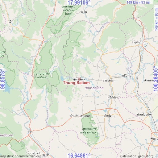
Thung Saliam GPS coordinates[2]
17° 19' 15.816" North, 99° 33' 39.312" East
| Map corner | latitude | longitude |
|---|---|---|
| Upper-left | 17.99106°, | 98.8578° |
| Center: | 17.32106°, | 99.56092° |
| Lower-right: | 16.64861°, | 100.26405° |
| Map W x H: | 149.3×149.3 km | = 92.8×92.8mi |
| max Lat: | 20.43353° ⇑17.7% North |
| Thung Saliam: | 17.32106° |
| min Lat: | ⇓82.3% South 5.77434° |
| min Long | Thung Saliam | max Long |
| 97.93288° | 99.56092° | 105.49506° |
| W 16%⇐ | ⇒84% E |
Elevation
Elevation of Thung Saliam is 94 m = 308 ft, and this is 31.5 m = 103 ft below average elevation for this country.
| Max E: |
1011 m = 3317 ft | 50.1% |
| Avg. | 125.5 m = 412 ft | |
| Thung Saliam | 94 m = 308 ft | |
Min E: |
1 m = 3 ft | 49.9% |
See also: Thailand elevation on elevation.city.
Geographical zone
Thung Saliam is located in North Torrid zone (between Equator and Tropic of Cancer). Distance of this Northern Tropic circle is 680 km =422.5 mi to North.| Distance of | km | miles | from Thung Saliam |
|---|---|---|---|
| North Pole | 8081.1 | 5021.4 | to North |
| Arctic Circle | 5475.3 | 3402.2 | to North |
| Tropic Cancer | 680 | 422.5 | to North |
| Equator | 1925.9 | 1196.7 | to South |


Nearby cities:
15 places around Thung Saliam: (largest is in red/bold)
• Ban Dan Lan Hoi
35 km =21.7 mi,  177°
177°
• Ban Na
38.4 km =23.9 mi,  151°
151°
• Ban Tak
59.6 km =37 mi,  238°
238°
• Khiri Mat
59.9 km =37.2 mi, 154°
• Kong Krailat
60.4 km =37.5 mi,  132°
132°
• Mae Phrik
49.4 km =30.7 mi,  286°
286°
• Phichai
55.9 km =34.7 mi,  93°
93°
• Sam Ngao
57.8 km =35.9 mi,  261°
261°
• Sawankhalok
28.8 km =17.9 mi, 91°
• Si Nakhon
45.2 km =28.1 mi, 86°
• Si Samrong
36.5 km =22.7 mi,  118°
118°
• Si Satchanalai
30.3 km =18.8 mi,  44°
44°
• Sukhothai
44.6 km =27.7 mi,  141°
141°
• Thoen
48.9 km =30.4 mi,  311°
311°
• Tron
61.2 km =38 mi,  73°
73°
Sources, notices
• [Note1] Compared only with cities in Thailand existing in our database
• [Src1] Map data: © OpenStreetMap contributors (CC-BY-SA)
• [Src2] Other city data from geonames.org with taken over terms of usage.
• [Src3] Geographical zone / Annual Mean Temperature by Robert A. Rohde @ Wikipedia
