Si Nakhon geodata
Si Nakhon (Sukhothai) is a seat of a second-order administrative division; located in Thailand in Asia/Bangkok (GMT+7) time zone. In our database, there are 331 cities with bigger population. Compared to other cities in Thailand, 82.7% of cities are located further ↓South; 72.9% of cities are located further →East and 54% of cities have higher elevation than Si Nakhon. Note1


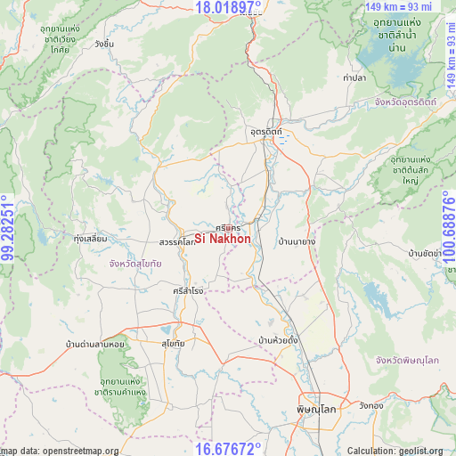
Si Nakhon GPS coordinates[2]
17° 20' 56.652" North, 99° 59' 8.268" East
| Map corner | latitude | longitude |
|---|---|---|
| Upper-left | 18.01897°, | 99.28251° |
| Center: | 17.34907°, | 99.98563° |
| Lower-right: | 16.67672°, | 100.68876° |
| Map W x H: | 149.2×149.2 km | = 92.7×92.7mi |
| max Lat: | 20.43353° ⇑17.3% North |
| Si Nakhon: | 17.34907° |
| min Lat: | ⇓82.7% South 5.77434° |
| min Long | Si Nakhon | max Long |
| 97.93288° | 99.98563° | 105.49506° |
| W 27.1%⇐ | ⇒72.9% E |
Elevation
Elevation of Si Nakhon is 62 m = 203 ft, and this is 63.5 m = 208 ft below average elevation for this country.
| Max E: |
1011 m = 3317 ft | 54% |
| Avg. | 125.5 m = 412 ft | |
| Si Nakhon | 62 m = 203 ft | |
Min E: |
1 m = 3 ft | 46% |
See also: Thailand elevation on elevation.city.
Geographical zone
Si Nakhon is located in North Torrid zone (between Equator and Tropic of Cancer). Distance of this Northern Tropic circle is 676.9 km =420.6 mi to North.| Distance of | km | miles | from Si Nakhon |
|---|---|---|---|
| North Pole | 8078 | 5019.4 | to North |
| Arctic Circle | 5472.1 | 3400.2 | to North |
| Tropic Cancer | 676.9 | 420.6 | to North |
| Equator | 1929 | 1198.6 | to South |


Nearby cities:
15 places around Si Nakhon: (largest is in red/bold)
• Ban Na
45.6 km =28.3 mi,  216°
216°
• Kong Krailat
44.2 km =27.5 mi,  181°
181°
• Lap Lae
34.2 km =21.3 mi,  9°
9°
• Laplae
34.2 km =21.3 mi, 9°
• Phichai
12.7 km =7.9 mi,  122°
122°
• Phrom Phiram
41.9 km =26 mi,  146°
146°
• Sawankhalok
16.7 km =10.4 mi,  257°
257°
• Si Samrong
24.4 km =15.2 mi,  212°
212°
• Si Satchanalai
30.4 km =18.9 mi,  307°
307°
• Sukhothai
41.7 km =25.9 mi,  204°
204°
• Thong Saen Khan
39.1 km =24.3 mi,  69°
69°
• Thung Saliam
45.2 km =28.1 mi,  266°
266°
• Tron
20 km =12.4 mi,  42°
42°
• Uttaradit
32.8 km =20.4 mi,  20°
20°
• Wat Bot
55 km =34.2 mi,  138°
138°
Sources, notices
• [Note1] Compared only with cities in Thailand existing in our database
• [Src1] Map data: © OpenStreetMap contributors (CC-BY-SA)
• [Src2] Other city data from geonames.org with taken over terms of usage.
• [Src3] Geographical zone / Annual Mean Temperature by Robert A. Rohde @ Wikipedia
