Lampang geodata
Lampang is a seat of a first-order administrative division; located in Thailand in Asia/Bangkok (GMT+7) time zone. With population of 156,139 people, there are 11 cities with bigger population in this country. Compared to other cities in Thailand, 91.2% of cities are located further ↓South; 85.6% of cities are located further →East and 87.3% of cities have lower elevation than Lampang. Note1


Lampang GPS coordinates[2]
18° 17' 32.352" North, 99° 29' 33.972" East
| Map corner | latitude | longitude |
|---|---|---|
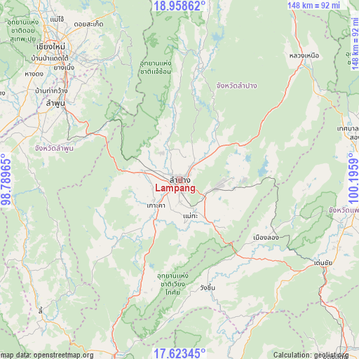
| Upper-left | 18.95862°, | 98.78965° |
| Center: | 18.29232°, | 99.49277° |
| Lower-right: | 17.62345°, | 100.1959° |
| Map W x H: | 148.5×148.5 km | = 92.3×92.3mi |
| max Lat: | 20.43353° ⇑8.8% North |
| Lampang: | 18.29232° |
| min Lat: | ⇓91.2% South 5.77434° |
| min Long | Lampang | max Long |
| 97.93288° | 99.49277° | 105.49506° |
| W 14.4%⇐ | ⇒85.6% E |
Elevation
Elevation of Lampang is 238 m = 781 ft, and this is 112.5 m = 369 ft above average elevation for this country.
| Max E: |
1011 m = 3317 ft | 12.7% |
| Lampang | 238 m 781 ft | |
| Avg. | 125.5 m = 412 ft | |
Min E: |
1 m = 3 ft | 87.3% |
See also: Lampang elevation on elevation.city.
Geographical zone
Lampang is located in North Torrid zone (between Equator and Tropic of Cancer). Distance of this Northern Tropic circle is 572 km =355.4 mi to North.| Distance of | km | miles | from Lampang |
|---|---|---|---|
| North Pole | 7973.1 | 4954.3 | to North |
| Arctic Circle | 5367.3 | 3335.1 | to North |
| Tropic Cancer | 572 | 355.4 | to North |
| Equator | 2033.9 | 1263.8 | to South |


Nearby cities:
15 places around Lampang: (largest is in red/bold)
• Ban Thi
54.8 km =34.1 mi,  313°
313°
• Chae Hom
47.2 km =29.3 mi,  8°
8°
• Hang Chat
16 km =9.9 mi,  284°
284°
• Ko Kha
15.2 km =9.4 mi,  223°
223°
• Lamphun
60.4 km =37.5 mi,  302°
302°
• Long
43.2 km =26.8 mi,  124°
124°
• Mae Mo
16.8 km =10.4 mi,  96°
96°
• Mae On
59.7 km =37.1 mi,  334°
334°
• Mae Tha
17.7 km =11 mi,  172°
172°
• Mae Tha
41.8 km =26 mi, 297°
• Mueang Pan
52.9 km =32.9 mi,  1°
1°
• Soem Ngam
36.4 km =22.6 mi,  225°
225°
• Sop Prap
48.7 km =30.3 mi,  199°
199°
• Thung Hua Chang
58.7 km =36.5 mi,  236°
236°
• Wang Chin
47.5 km =29.5 mi,  164°
164°
Sources, notices
• [Note1] Compared only with cities in Thailand existing in our database
• [Src1] Map data: © OpenStreetMap contributors (CC-BY-SA)
• [Src2] Other city data from geonames.org with taken over terms of usage.
• [Src3] Geographical zone / Annual Mean Temperature by Robert A. Rohde @ Wikipedia
