Khlong Khlung geodata
Khlong Khlung (Kamphaeng Phet) is a seat of a second-order administrative division; located in Thailand in Asia/Bangkok (GMT+7) time zone. In our database, there are 331 cities with bigger population. Compared to other cities in Thailand, 68.7% of cities are located further ↓South; 80.6% of cities are located further →East and 54% of cities have higher elevation than Khlong Khlung. Note1


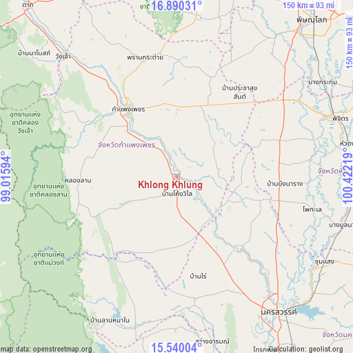
Khlong Khlung GPS coordinates[2]
16° 12' 58.788" North, 99° 43' 8.616" East
| Map corner | latitude | longitude |
|---|---|---|
| Upper-left | 16.89031°, | 99.01594° |
| Center: | 16.21633°, | 99.71906° |
| Lower-right: | 15.54004°, | 100.42219° |
| Map W x H: | 150.1×150.1 km | = 93.3×93.3mi |
| max Lat: | 20.43353° ⇑31.3% North |
| Khlong Khlung: | 16.21633° |
| min Lat: | ⇓68.7% South 5.77434° |
| min Long | Khlong Khlung | max Long |
| 97.93288° | 99.71906° | 105.49506° |
| W 19.4%⇐ | ⇒80.6% E |
Elevation
Elevation of Khlong Khlung is 62 m = 203 ft, and this is 63.5 m = 208 ft below average elevation for this country.
| Max E: |
1011 m = 3317 ft | 54% |
| Avg. | 125.5 m = 412 ft | |
| Khlong Khlung | 62 m = 203 ft | |
Min E: |
1 m = 3 ft | 46% |
See also: Thailand elevation on elevation.city.
Geographical zone
Khlong Khlung is located in North Torrid zone (between Equator and Tropic of Cancer). Distance of this Northern Tropic circle is 802.8 km =498.8 mi to North.| Distance of | km | miles | from Khlong Khlung |
|---|---|---|---|
| North Pole | 8204 | 5097.7 | to North |
| Arctic Circle | 5598.1 | 3478.5 | to North |
| Tropic Cancer | 802.8 | 498.8 | to North |
| Equator | 1803.1 | 1120.4 | to South |


Nearby cities:
15 places around Khlong Khlung: (largest is in red/bold)
• Banphot Phisai
41.9 km =26 mi,  138°
138°
• Bueng Na Rang
43.7 km =27.2 mi,  96°
96°
• Bueng Samakkhi
27.5 km =17.1 mi, 96°
• Kamphaeng Phet
36.4 km =22.6 mi,  324°
324°
• Kao Liao
56 km =34.8 mi, 136°
• Khanu Woralaksaburi
22.9 km =14.2 mi, 138°
• Khlong Lan
42.6 km =26.5 mi,  268°
268°
• Lan Krabue
44.9 km =27.9 mi,  17°
17°
• Lat Yao
52.3 km =32.5 mi,  171°
171°
• Mae Wong
52.9 km =32.9 mi,  203°
203°
• Pang Sila Thong
28 km =17.4 mi,  241°
241°
• Phran Kratai
51.8 km =32.2 mi,  344°
344°
• Sai Ngam
33.4 km =20.8 mi,  32°
32°
• Thung Sai
16.3 km =10.1 mi,  47°
47°
• Wachira Barami
56.8 km =35.3 mi, 53°
Sources, notices
• [Note1] Compared only with cities in Thailand existing in our database
• [Src1] Map data: © OpenStreetMap contributors (CC-BY-SA)
• [Src2] Other city data from geonames.org with taken over terms of usage.
• [Src3] Geographical zone / Annual Mean Temperature by Robert A. Rohde @ Wikipedia
