Tha Khanon geodata
Tha Khanon (Surat Thani) is a seat of a second-order administrative division; located in Thailand in Asia/Bangkok (GMT+7) time zone. With population of 7,300 people, there are 300 cities with bigger population in this country. Compared to other cities in Thailand, 84.9% of cities are located further ↑North; 92.4% of cities are located further →East and 70.3% of cities have higher elevation than Tha Khanon. Note1


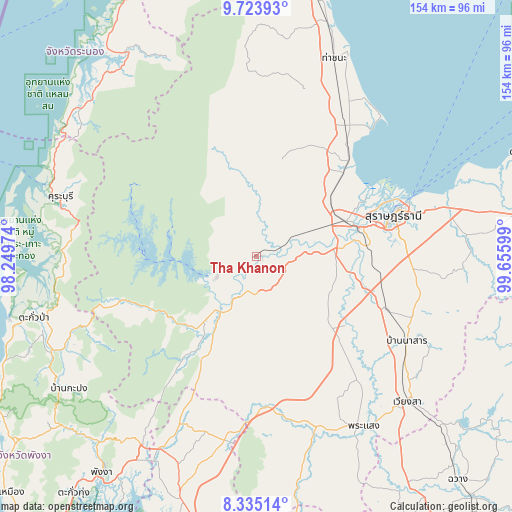
Tha Khanon GPS coordinates[2]
9° 1' 48.72" North, 98° 57' 10.296" East
| Map corner | latitude | longitude |
|---|---|---|
| Upper-left | 9.72393°, | 98.24974° |
| Center: | 9.0302°, | 98.95286° |
| Lower-right: | 8.33514°, | 99.65599° |
| Map W x H: | 154.4×154.4 km | = 95.9×95.9mi |
| max Lat: | 20.43353° ⇑84.9% North |
| Tha Khanon: | 9.0302° |
| min Lat: | ⇓15.1% South 5.77434° |
| min Long | Tha Khanon | max Long |
| 97.93288° | 98.95286° | 105.49506° |
| W 7.6%⇐ | ⇒92.4% E |
Elevation
Elevation of Tha Khanon is 22 m = 72 ft, and this is 103.5 m = 340 ft below average elevation for this country.
| Max E: |
1011 m = 3317 ft | 70.3% |
| Avg. | 125.5 m = 412 ft | |
| Tha Khanon | 22 m = 72 ft | |
Min E: |
1 m = 3 ft | 29.7% |
See also: Thailand elevation on elevation.city.
Geographical zone
Tha Khanon is located in North Torrid zone (between Equator and Tropic of Cancer). Distance of Equator is 1004.1 km =623.9 mi to South.| Distance of | km | miles | from Tha Khanon |
|---|---|---|---|
| North Pole | 9003 | 5594.2 | to North |
| Arctic Circle | 6397.1 | 3975 | to North |
| Tropic Cancer | 1601.9 | 995.4 | to North |
| Equator | 1004.1 | 623.9 | to South |


Nearby cities:
15 places around Tha Khanon: (largest is in red/bold)
• Ban Na Doem
42.5 km =26.4 mi,  112°
112°
• Ban Na San
51.9 km =32.2 mi,  119°
119°
• Ban Takhun
15.9 km =9.9 mi,  208°
208°
• Chaiya
47.9 km =29.8 mi,  34°
34°
• Kanchanadit
58.8 km =36.5 mi,  75°
75°
• Khian Sa
34.1 km =21.2 mi,  127°
127°
• Khura Buri
61.8 km =38.4 mi,  287°
287°
• Phanom
24.9 km =15.5 mi,  218°
218°
• Phrasaeng
60.8 km =37.8 mi,  147°
147°
• Plai Phraya
56.2 km =34.9 mi,  190°
190°
• Surat Thani
43.5 km =27 mi,  73°
73°
• Takuk Nuea
23.4 km =14.5 mi,  6°
6°
• Tha Chang
37 km =23 mi,  45°
45°
• Tha Kham
31.9 km =19.8 mi, 73°
• Wiang Sa
63.2 km =39.3 mi, 133°
Sources, notices
• [Note1] Compared only with cities in Thailand existing in our database
• [Src1] Map data: © OpenStreetMap contributors (CC-BY-SA)
• [Src2] Other city data from geonames.org with taken over terms of usage.
• [Src3] Geographical zone / Annual Mean Temperature by Robert A. Rohde @ Wikipedia
