Ban Na Doem geodata
Ban Na Doem (Surat Thani) is a seat of a second-order administrative division; located in Thailand in Asia/Bangkok (GMT+7) time zone. In our database, there are 331 cities with bigger population. Compared to other cities in Thailand, 85.1% of cities are located further ↑North; 87.9% of cities are located further →East and 63.3% of cities have higher elevation than Ban Na Doem. Note1


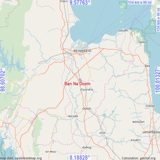
Ban Na Doem GPS coordinates[2]
8° 53' 0.996" North, 99° 18' 36.504" East
| Map corner | latitude | longitude |
|---|---|---|
| Upper-left | 9.57763°, | 98.60702° |
| Center: | 8.88361°, | 99.31014° |
| Lower-right: | 8.18828°, | 100.01327° |
| Map W x H: | 154.5×154.5 km | = 96×96mi |
| max Lat: | 20.43353° ⇑85.1% North |
| Ban Na Doem: | 8.88361° |
| min Lat: | ⇓14.9% South 5.77434° |
| min Long | Ban Na Doem | max Long |
| 97.93288° | 99.31014° | 105.49506° |
| W 12.1%⇐ | ⇒87.9% E |
Elevation
Elevation of Ban Na Doem is 36 m = 118 ft, and this is 89.5 m = 294 ft below average elevation for this country.
| Max E: |
1011 m = 3317 ft | 63.3% |
| Avg. | 125.5 m = 412 ft | |
| Ban Na Doem | 36 m = 118 ft | |
Min E: |
1 m = 3 ft | 36.7% |
See also: Thailand elevation on elevation.city.
Geographical zone
Ban Na Doem is located in North Torrid zone (between Equator and Tropic of Cancer). Distance of Equator is 987.8 km =613.8 mi to South.| Distance of | km | miles | from Ban Na Doem |
|---|---|---|---|
| North Pole | 9019.3 | 5604.3 | to North |
| Arctic Circle | 6413.4 | 3985.1 | to North |
| Tropic Cancer | 1618.2 | 1005.5 | to North |
| Equator | 987.8 | 613.8 | to South |


Nearby cities:
15 places around Ban Na Doem: (largest is in red/bold)
• Ban Na San
11 km =6.8 mi,  147°
147°
• Ban Takhun
46.8 km =29.1 mi,  272°
272°
• Chai Buri
53.4 km =33.2 mi,  208°
208°
• Kanchanadit
36 km =22.4 mi,  29°
29°
• Khian Sa
13.1 km =8.1 mi,  249°
249°
• Nopphitam
51.4 km =31.9 mi,  110°
110°
• Phipun
48.5 km =30.1 mi,  137°
137°
• Phrasaeng
35.8 km =22.2 mi,  191°
191°
• Surat Thani
28.6 km =17.8 mi,  5°
5°
• Takuk Nuea
53.7 km =33.4 mi,  317°
317°
• Tha Chang
44.3 km =27.5 mi,  342°
342°
• Tha Kham
26.7 km =16.6 mi, 341°
• Tha Khanon
42.5 km =26.4 mi,  292°
292°
• Tham Phannara
52.3 km =32.5 mi,  169°
169°
• Wiang Sa
28.2 km =17.5 mi, 167°
Sources, notices
• [Note1] Compared only with cities in Thailand existing in our database
• [Src1] Map data: © OpenStreetMap contributors (CC-BY-SA)
• [Src2] Other city data from geonames.org with taken over terms of usage.
• [Src3] Geographical zone / Annual Mean Temperature by Robert A. Rohde @ Wikipedia
