Phanom geodata
Phanom (Surat Thani) is a seat of a second-order administrative division; located in Thailand in Asia/Bangkok (GMT+7) time zone. In our database, there are 331 cities with bigger population. Compared to other cities in Thailand, 85.3% of cities are located further ↑North; 93.7% of cities are located further →East and 56.8% of cities have higher elevation than Phanom. Note1


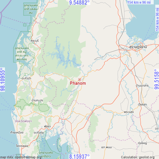
Phanom GPS coordinates[2]
8° 51' 17.1" North, 98° 48' 45.612" East
| Map corner | latitude | longitude |
|---|---|---|
| Upper-left | 9.54882°, | 98.10955° |
| Center: | 8.85475°, | 98.81267° |
| Lower-right: | 8.15937°, | 99.5158° |
| Map W x H: | 154.5×154.5 km | = 96×96mi |
| max Lat: | 20.43353° ⇑85.3% North |
| Phanom: | 8.85475° |
| min Lat: | ⇓14.7% South 5.77434° |
| min Long | Phanom | max Long |
| 97.93288° | 98.81267° | 105.49506° |
| W 6.3%⇐ | ⇒93.7% E |
Elevation
Elevation of Phanom is 52 m = 171 ft, and this is 73.5 m = 241 ft below average elevation for this country.
| Max E: |
1011 m = 3317 ft | 56.8% |
| Avg. | 125.5 m = 412 ft | |
| Phanom | 52 m = 171 ft | |
Min E: |
1 m = 3 ft | 43.2% |
See also: Thailand elevation on elevation.city.
Geographical zone
Phanom is located in North Torrid zone (between Equator and Tropic of Cancer). Distance of Equator is 984.6 km =611.8 mi to South.| Distance of | km | miles | from Phanom |
|---|---|---|---|
| North Pole | 9022.5 | 5606.3 | to North |
| Arctic Circle | 6416.6 | 3987.1 | to North |
| Tropic Cancer | 1621.4 | 1007.5 | to North |
| Equator | 984.6 | 611.8 | to South |


Nearby cities:
15 places around Phanom: (largest is in red/bold)
• Ao Luek
54 km =33.6 mi,  190°
190°
• Ban Na Doem
54.7 km =34 mi,  86°
86°
• Ban Takhun
9.6 km =6 mi,  55°
55°
• Chai Buri
52.4 km =32.6 mi,  146°
146°
• Kapong
47.7 km =29.6 mi,  248°
248°
• Khian Sa
42.4 km =26.3 mi, 91°
• Khura Buri
57.7 km =35.9 mi,  310°
310°
• Phang Nga
54.6 km =33.9 mi,  214°
214°
• Phrasaeng
57.5 km =35.7 mi,  123°
123°
• Plai Phraya
36.2 km =22.5 mi,  171°
171°
• Takua Pa
51.5 km =32 mi,  271°
271°
• Takuk Nuea
46.4 km =28.8 mi,  23°
23°
• Tha Kham
54.1 km =33.6 mi, 58°
• Tha Khanon
24.9 km =15.5 mi,  38°
38°
• Thap Put
42.2 km =26.2 mi, 206°
Sources, notices
• [Note1] Compared only with cities in Thailand existing in our database
• [Src1] Map data: © OpenStreetMap contributors (CC-BY-SA)
• [Src2] Other city data from geonames.org with taken over terms of usage.
• [Src3] Geographical zone / Annual Mean Temperature by Robert A. Rohde @ Wikipedia
