Wang Nuea geodata
Wang Nuea (Lampang) is a seat of a second-order administrative division; located in Thailand in Asia/Bangkok (GMT+7) time zone. In our database, there are 331 cities with bigger population. Compared to other cities in Thailand, 95.5% of cities are located further ↓South; 82.7% of cities are located further →East and 96.6% of cities have lower elevation than Wang Nuea. Note1


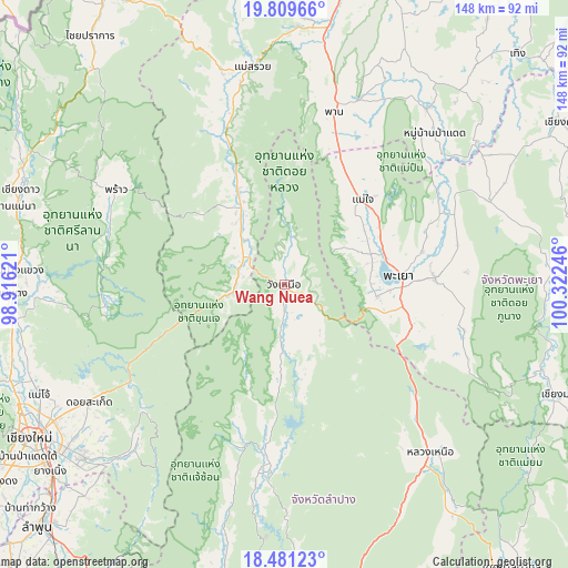
Wang Nuea GPS coordinates[2]
19° 8' 48.408" North, 99° 37' 9.588" East
| Map corner | latitude | longitude |
|---|---|---|
| Upper-left | 19.80966°, | 98.91621° |
| Center: | 19.14678°, | 99.61933° |
| Lower-right: | 18.48123°, | 100.32246° |
| Map W x H: | 147.7×147.7 km | = 91.8×91.8mi |
| max Lat: | 20.43353° ⇑4.5% North |
| Wang Nuea: | 19.14678° |
| min Lat: | ⇓95.5% South 5.77434° |
| min Long | Wang Nuea | max Long |
| 97.93288° | 99.61933° | 105.49506° |
| W 17.3%⇐ | ⇒82.7% E |
Elevation
Elevation of Wang Nuea is 420 m = 1378 ft, and this is 294.5 m = 966 ft above average elevation for this country.
| Max E: |
1011 m = 3317 ft | 3.4% |
| Wang Nuea | 420 m 1378 ft | |
| Avg. | 125.5 m = 412 ft | |
Min E: |
1 m = 3 ft | 96.6% |
See also: Thailand elevation on elevation.city.
Geographical zone
Wang Nuea is located in North Torrid zone (between Equator and Tropic of Cancer). Distance of this Northern Tropic circle is 477 km =296.4 mi to North.| Distance of | km | miles | from Wang Nuea |
|---|---|---|---|
| North Pole | 7878.1 | 4895.2 | to North |
| Arctic Circle | 5272.3 | 3276.1 | to North |
| Tropic Cancer | 477 | 296.4 | to North |
| Equator | 2128.9 | 1322.8 | to South |


Nearby cities:
15 places around Wang Nuea: (largest is in red/bold)
• Chae Hom
48.7 km =30.3 mi,  187°
187°
• Chun
58.1 km =36.1 mi,  68°
68°
• Dok Kham Tai
39.3 km =24.4 mi,  87°
87°
• Mae Chai
30.1 km =18.7 mi,  42°
42°
• Mae On
56.7 km =35.2 mi,  223°
223°
• Mae Suai
57.2 km =35.5 mi,  352°
352°
• Mueang Pan
43.9 km =27.3 mi,  196°
196°
• Ngao
57.5 km =35.7 mi,  138°
138°
• Pa Daet
55.8 km =34.7 mi, 44°
• Phan
47 km =29.2 mi,  15°
15°
• Phayao
27.7 km =17.2 mi,  79°
79°
• Phrao
50.1 km =31.1 mi,  299°
299°
• Phu Kam Yao
39.3 km =24.4 mi, 69°
• Pong
68.9 km =42.8 mi, 89°
• Wiang Pa Pao
25.3 km =15.7 mi,  332°
332°
Sources, notices
• [Note1] Compared only with cities in Thailand existing in our database
• [Src1] Map data: © OpenStreetMap contributors (CC-BY-SA)
• [Src2] Other city data from geonames.org with taken over terms of usage.
• [Src3] Geographical zone / Annual Mean Temperature by Robert A. Rohde @ Wikipedia
