Chai Buri geodata
Chai Buri (Surat Thani) is a seat of a second-order administrative division; located in Thailand in Asia/Bangkok (GMT+7) time zone. With population of 6,126 people, there are 303 cities with bigger population in this country. Compared to other cities in Thailand, 86.6% of cities are located further ↑North; 91.2% of cities are located further →East and 59.6% of cities have higher elevation than Chai Buri. Note1


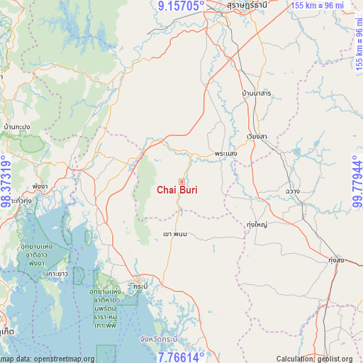
Chai Buri GPS coordinates[2]
8° 27' 43.992" North, 99° 4' 34.716" East
| Map corner | latitude | longitude |
|---|---|---|
| Upper-left | 9.15705°, | 98.37319° |
| Center: | 8.46222°, | 99.07631° |
| Lower-right: | 7.76614°, | 99.77944° |
| Map W x H: | 154.7×154.7 km | = 96.1×96.1mi |
| max Lat: | 20.43353° ⇑86.6% North |
| Chai Buri: | 8.46222° |
| min Lat: | ⇓13.4% South 5.77434° |
| min Long | Chai Buri | max Long |
| 97.93288° | 99.07631° | 105.49506° |
| W 8.8%⇐ | ⇒91.2% E |
Elevation
Elevation of Chai Buri is 46 m = 151 ft, and this is 79.5 m = 261 ft below average elevation for this country.
| Max E: |
1011 m = 3317 ft | 59.6% |
| Avg. | 125.5 m = 412 ft | |
| Chai Buri | 46 m = 151 ft | |
Min E: |
1 m = 3 ft | 40.4% |
See also: Thailand elevation on elevation.city.
Geographical zone
Chai Buri is located in North Torrid zone (between Equator and Tropic of Cancer). Distance of Equator is 940.9 km =584.6 mi to South.| Distance of | km | miles | from Chai Buri |
|---|---|---|---|
| North Pole | 9066.2 | 5633.5 | to North |
| Arctic Circle | 6460.3 | 4014.2 | to North |
| Tropic Cancer | 1665 | 1034.6 | to North |
| Equator | 940.9 | 584.6 | to South |


Nearby cities:
15 places around Chai Buri: (largest is in red/bold)
• Ao Luek
40.2 km =25 mi,  256°
256°
• Ban Na San
49.1 km =30.5 mi,  40°
40°
• Chawang
47.3 km =29.4 mi,  94°
94°
• Khao Phanom
22 km =13.7 mi,  187°
187°
• Khian Sa
44.4 km =27.6 mi,  17°
17°
• Krabi
47 km =29.2 mi,  202°
202°
• Lam Thap
49.4 km =30.7 mi,  151°
151°
• Nuea Khlong
44.3 km =27.5 mi, 191°
• Phanom
52.4 km =32.6 mi,  326°
326°
• Phrasaeng
22.2 km =13.8 mi,  58°
58°
• Plai Phraya
24.7 km =15.3 mi,  288°
288°
• Tham Phannara
35.4 km =22 mi,  97°
97°
• Thap Put
48.4 km =30.1 mi,  277°
277°
• Thung Yai
36.6 km =22.7 mi,  119°
119°
• Wiang Sa
37.3 km =23.2 mi, 58°
Sources, notices
• [Note1] Compared only with cities in Thailand existing in our database
• [Src1] Map data: © OpenStreetMap contributors (CC-BY-SA)
• [Src2] Other city data from geonames.org with taken over terms of usage.
• [Src3] Geographical zone / Annual Mean Temperature by Robert A. Rohde @ Wikipedia
