Khao Phanom geodata
Khao Phanom (Krabi) is a seat of a second-order administrative division; located in Thailand in Asia/Bangkok (GMT+7) time zone. In our database, there are 331 cities with bigger population. Compared to other cities in Thailand, 87.9% of cities are located further ↑North; 91.3% of cities are located further →East and 55% of cities have higher elevation than Khao Phanom. Note1


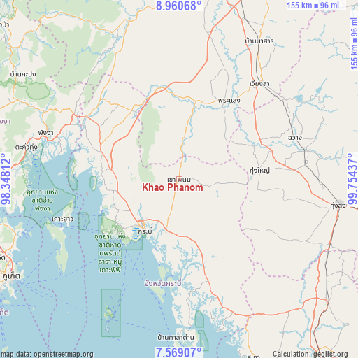
Khao Phanom GPS coordinates[2]
8° 15' 55.764" North, 99° 3' 4.464" East
| Map corner | latitude | longitude |
|---|---|---|
| Upper-left | 8.96068°, | 98.34812° |
| Center: | 8.26549°, | 99.05124° |
| Lower-right: | 7.56907°, | 99.75437° |
| Map W x H: | 154.7×154.7 km | = 96.1×96.1mi |
| max Lat: | 20.43353° ⇑87.9% North |
| Khao Phanom: | 8.26549° |
| min Lat: | ⇓12.1% South 5.77434° |
| min Long | Khao Phanom | max Long |
| 97.93288° | 99.05124° | 105.49506° |
| W 8.7%⇐ | ⇒91.3% E |
Elevation
Elevation of Khao Phanom is 59 m = 194 ft, and this is 66.5 m = 218 ft below average elevation for this country.
| Max E: |
1011 m = 3317 ft | 55% |
| Avg. | 125.5 m = 412 ft | |
| Khao Phanom | 59 m = 194 ft | |
Min E: |
1 m = 3 ft | 45% |
See also: Thailand elevation on elevation.city.
Geographical zone
Khao Phanom is located in North Torrid zone (between Equator and Tropic of Cancer). Distance of Equator is 919 km =571 mi to South.| Distance of | km | miles | from Khao Phanom |
|---|---|---|---|
| North Pole | 9088 | 5647 | to North |
| Arctic Circle | 6482.1 | 4027.8 | to North |
| Tropic Cancer | 1686.9 | 1048.2 | to North |
| Equator | 919 | 571 | to South |


Nearby cities:
15 places around Khao Phanom: (largest is in red/bold)
• Ao Luek
38.4 km =23.9 mi,  289°
289°
• Ban Ao Nang
36.1 km =22.4 mi,  227°
227°
• Bang Khan
53.5 km =33.2 mi,  119°
119°
• Chai Buri
22 km =13.7 mi,  7°
7°
• Chawang
53 km =32.9 mi,  70°
70°
• Khlong Thom
37.9 km =23.5 mi,  164°
164°
• Ko Yao
53.4 km =33.2 mi,  251°
251°
• Krabi
26.5 km =16.5 mi,  215°
215°
• Lam Thap
34.1 km =21.2 mi,  129°
129°
• Nuea Khlong
22.3 km =13.9 mi,  194°
194°
• Phrasaeng
40 km =24.9 mi,  32°
32°
• Plai Phraya
36.2 km =22.5 mi,  325°
325°
• Tham Phannara
41.6 km =25.8 mi, 65°
• Thap Put
53.2 km =33.1 mi,  301°
301°
• Thung Yai
34.9 km =21.7 mi,  83°
83°
Sources, notices
• [Note1] Compared only with cities in Thailand existing in our database
• [Src1] Map data: © OpenStreetMap contributors (CC-BY-SA)
• [Src2] Other city data from geonames.org with taken over terms of usage.
• [Src3] Geographical zone / Annual Mean Temperature by Robert A. Rohde @ Wikipedia
