Tham Phannara geodata
Tham Phannara (Nakhon Si Thammarat) is a seat of a second-order administrative division; located in Thailand in Asia/Bangkok (GMT+7) time zone. With population of 7,119 people, there are 301 cities with bigger population in this country. Compared to other cities in Thailand, 87% of cities are located further ↑North; 86.6% of cities are located further →East and 56.4% of cities have higher elevation than Tham Phannara. Note1


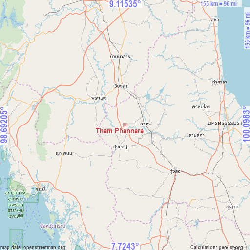
Tham Phannara GPS coordinates[2]
8° 25' 13.62" North, 99° 23' 42.612" East
| Map corner | latitude | longitude |
|---|---|---|
| Upper-left | 9.11535°, | 98.69205° |
| Center: | 8.42045°, | 99.39517° |
| Lower-right: | 7.7243°, | 100.0983° |
| Map W x H: | 154.7×154.7 km | = 96.1×96.1mi |
| max Lat: | 20.43353° ⇑87% North |
| Tham Phannara: | 8.42045° |
| min Lat: | ⇓13% South 5.77434° |
| min Long | Tham Phannara | max Long |
| 97.93288° | 99.39517° | 105.49506° |
| W 13.4%⇐ | ⇒86.6% E |
Elevation
Elevation of Tham Phannara is 54 m = 177 ft, and this is 71.5 m = 235 ft below average elevation for this country.
| Max E: |
1011 m = 3317 ft | 56.4% |
| Avg. | 125.5 m = 412 ft | |
| Tham Phannara | 54 m = 177 ft | |
Min E: |
1 m = 3 ft | 43.6% |
See also: Thailand elevation on elevation.city.
Geographical zone
Tham Phannara is located in North Torrid zone (between Equator and Tropic of Cancer). Distance of Equator is 936.3 km =581.8 mi to South.| Distance of | km | miles | from Tham Phannara |
|---|---|---|---|
| North Pole | 9070.8 | 5636.3 | to North |
| Arctic Circle | 6464.9 | 4017.1 | to North |
| Tropic Cancer | 1669.7 | 1037.5 | to North |
| Equator | 936.3 | 581.8 | to South |


Nearby cities:
15 places around Tham Phannara: (largest is in red/bold)
• Ban Na San
42.4 km =26.3 mi,  355°
355°
• Bang Khan
44.6 km =27.7 mi,  168°
168°
• Chai Buri
35.4 km =22 mi,  277°
277°
• Chang Klang
19.2 km =11.9 mi,  106°
106°
• Chawang
12.1 km =7.5 mi,  86°
86°
• Khao Phanom
41.6 km =25.8 mi,  245°
245°
• Lam Thap
40.3 km =25 mi,  196°
196°
• Lan Saka
45.5 km =28.3 mi,  96°
96°
• Na Bon
28.2 km =17.5 mi,  128°
128°
• Phipun
28 km =17.4 mi,  56°
56°
• Phrasaeng
23.1 km =14.4 mi,  315°
315°
• Phrom Khiri
48.4 km =30.1 mi,  76°
76°
• Thung Song
42.4 km =26.3 mi, 132°
• Thung Yai
13.6 km =8.5 mi,  193°
193°
• Wiang Sa
24.2 km =15 mi,  352°
352°
Sources, notices
• [Note1] Compared only with cities in Thailand existing in our database
• [Src1] Map data: © OpenStreetMap contributors (CC-BY-SA)
• [Src2] Other city data from geonames.org with taken over terms of usage.
• [Src3] Geographical zone / Annual Mean Temperature by Robert A. Rohde @ Wikipedia
