Phon Charoen geodata
Phon Charoen (Nong Khai) is a populated place; located in Thailand in Asia/Bangkok (GMT+7) time zone. With population of 15,208 people, there are 215 cities with bigger population in this country. Compared to other cities in Thailand, 89.5% of cities are located further ↓South; 81% of cities are located further ←West and 70.6% of cities have lower elevation than Phon Charoen. Note1


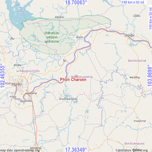
Phon Charoen GPS coordinates[2]
18° 1' 59.988" North, 103° 10' 0.012" East
| Map corner | latitude | longitude |
|---|---|---|
| Upper-left | 18.70063°, | 102.46355° |
| Center: | 18.03333°, | 103.16667° |
| Lower-right: | 17.36349°, | 103.8698° |
| Map W x H: | 148.7×148.7 km | = 92.4×92.4mi |
| max Lat: | 20.43353° ⇑10.5% North |
| Phon Charoen: | 18.03333° |
| min Lat: | ⇓89.5% South 5.77434° |
| min Long | Phon Charoen | max Long |
| 97.93288° | 103.16667° | 105.49506° |
| W 81%⇐ | ⇒19% E |
Elevation
Elevation of Phon Charoen is 170 m = 558 ft, and this is 44.5 m = 146 ft above average elevation for this country.
| Max E: |
1011 m = 3317 ft | 29.4% |
| Phon Charoen | 170 m 558 ft | |
| Avg. | 125.5 m = 412 ft | |
Min E: |
1 m = 3 ft | 70.6% |
See also: Thailand elevation on elevation.city.
Geographical zone
Phon Charoen is located in North Torrid zone (between Equator and Tropic of Cancer). Distance of this Northern Tropic circle is 600.8 km =373.3 mi to North.| Distance of | km | miles | from Phon Charoen |
|---|---|---|---|
| North Pole | 8001.9 | 4972.1 | to North |
| Arctic Circle | 5396.1 | 3353 | to North |
| Tropic Cancer | 600.8 | 373.3 | to North |
| Equator | 2005.1 | 1245.9 | to South |


Nearby cities:
15 places around Phon Charoen: (largest is in red/bold)
• Ban Dung
38.5 km =23.9 mi,  165°
165°
• Ban Muang
47.2 km =29.3 mi,  115°
115°
• Fao Rai
14.6 km =9.1 mi,  96°
96°
• Nong Khai
48.1 km =29.9 mi,  249°
249°
• Pak Khat
33.6 km =20.9 mi,  25°
25°
• Pakkhat
32.9 km =20.4 mi, 26°
• Phen
46.5 km =28.9 mi,  216°
216°
• Phibun Rak
54.6 km =33.9 mi,  192°
192°
• Phon Charoen
57.4 km =35.7 mi,  90°
90°
• Phon Phisai
9.6 km =6 mi,  261°
261°
• Phonphisai
9.6 km =6 mi, 261°
• Rattanawapi
20.1 km =12.5 mi,  3°
3°
• Sa Khrai
59.3 km =36.8 mi,  227°
227°
• Sang Khom
24.3 km =15.1 mi,  198°
198°
• So Phisai
29.6 km =18.4 mi,  80°
80°
Sources, notices
• [Note1] Compared only with cities in Thailand existing in our database
• [Src1] Map data: © OpenStreetMap contributors (CC-BY-SA)
• [Src2] Other city data from geonames.org with taken over terms of usage.
• [Src3] Geographical zone / Annual Mean Temperature by Robert A. Rohde @ Wikipedia
