Na Noi geodata
Na Noi (Nan) is a seat of a second-order administrative division; located in Thailand in Asia/Bangkok (GMT+7) time zone. In our database, there are 331 cities with bigger population. Compared to other cities in Thailand, 91.6% of cities are located further ↓South; 51.3% of cities are located further →East and 89.7% of cities have lower elevation than Na Noi. Note1


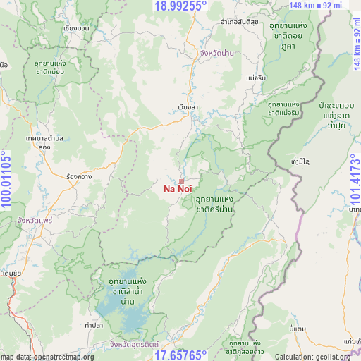
Na Noi GPS coordinates[2]
18° 19' 35.004" North, 100° 42' 51.012" East
| Map corner | latitude | longitude |
|---|---|---|
| Upper-left | 18.99255°, | 100.01105° |
| Center: | 18.32639°, | 100.71417° |
| Lower-right: | 17.65765°, | 101.4173° |
| Map W x H: | 148.4×148.4 km | = 92.2×92.2mi |
| max Lat: | 20.43353° ⇑8.4% North |
| Na Noi: | 18.32639° |
| min Lat: | ⇓91.6% South 5.77434° |
| min Long | Na Noi | max Long |
| 97.93288° | 100.71417° | 105.49506° |
| W 48.7%⇐ | ⇒51.3% E |
Elevation
Elevation of Na Noi is 274 m = 899 ft, and this is 148.5 m = 487 ft above average elevation for this country.
| Max E: |
1011 m = 3317 ft | 10.3% |
| Na Noi | 274 m 899 ft | |
| Avg. | 125.5 m = 412 ft | |
Min E: |
1 m = 3 ft | 89.7% |
See also: Thailand elevation on elevation.city.
Geographical zone
Na Noi is located in North Torrid zone (between Equator and Tropic of Cancer). Distance of this Northern Tropic circle is 568.2 km =353.1 mi to North.| Distance of | km | miles | from Na Noi |
|---|---|---|---|
| North Pole | 7969.4 | 4952 | to North |
| Arctic Circle | 5363.5 | 3332.7 | to North |
| Tropic Cancer | 568.2 | 353.1 | to North |
| Equator | 2037.7 | 1266.2 | to South |


Nearby cities:
15 places around Na Noi: (largest is in red/bold)
• Ban Khok
50.1 km =31.1 mi,  131°
131°
• Ban Luang
65.1 km =40.5 mi,  333°
333°
• Fak Tha
40.4 km =25.1 mi,  154°
154°
• Mae Charim
52.2 km =32.4 mi,  36°
36°
• Na Muen
16.3 km =10.1 mi,  200°
200°
• Nam Pat
66.6 km =41.4 mi,  182°
182°
• Nan
51.3 km =31.9 mi,  7°
7°
• Nong Muang Khai
55.8 km =34.7 mi,  262°
262°
• Phrae
63.8 km =39.6 mi,  251°
251°
• Phu Phiang
47.1 km =29.3 mi, 11°
• Rong Kwang
41.9 km =26 mi,  271°
271°
• Santi Suk
69.6 km =43.2 mi,  20°
20°
• Song
58.3 km =36.2 mi,  286°
286°
• Tha Pla
69.4 km =43.1 mi,  210°
210°
• Wiang Sa
30.4 km =18.9 mi, 5°
Sources, notices
• [Note1] Compared only with cities in Thailand existing in our database
• [Src1] Map data: © OpenStreetMap contributors (CC-BY-SA)
• [Src2] Other city data from geonames.org with taken over terms of usage.
• [Src3] Geographical zone / Annual Mean Temperature by Robert A. Rohde @ Wikipedia
