Fak Tha geodata
Fak Tha (Uttaradit) is a seat of a second-order administrative division; located in Thailand in Asia/Bangkok (GMT+7) time zone. In our database, there are 331 cities with bigger population. Compared to other cities in Thailand, 88.6% of cities are located further ↓South; 52.4% of cities are located further ←West and 86.5% of cities have lower elevation than Fak Tha. Note1


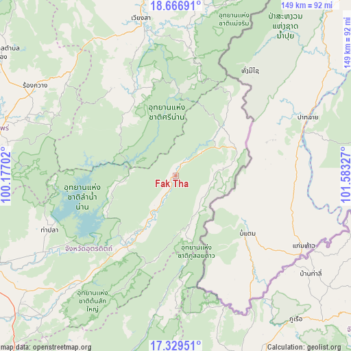
Fak Tha GPS coordinates[2]
17° 59' 58.128" North, 100° 52' 48.504" East
| Map corner | latitude | longitude |
|---|---|---|
| Upper-left | 18.66691°, | 100.17702° |
| Center: | 17.99948°, | 100.88014° |
| Lower-right: | 17.32951°, | 101.58327° |
| Map W x H: | 148.7×148.7 km | = 92.4×92.4mi |
| max Lat: | 20.43353° ⇑11.4% North |
| Fak Tha: | 17.99948° |
| min Lat: | ⇓88.6% South 5.77434° |
| min Long | Fak Tha | max Long |
| 97.93288° | 100.88014° | 105.49506° |
| W 52.4%⇐ | ⇒47.6% E |
Elevation
Elevation of Fak Tha is 227 m = 745 ft, and this is 101.5 m = 333 ft above average elevation for this country.
| Max E: |
1011 m = 3317 ft | 13.5% |
| Fak Tha | 227 m 745 ft | |
| Avg. | 125.5 m = 412 ft | |
Min E: |
1 m = 3 ft | 86.5% |
See also: Thailand elevation on elevation.city.
Geographical zone
Fak Tha is located in North Torrid zone (between Equator and Tropic of Cancer). Distance of this Northern Tropic circle is 604.6 km =375.7 mi to North.| Distance of | km | miles | from Fak Tha |
|---|---|---|---|
| North Pole | 8005.7 | 4974.5 | to North |
| Arctic Circle | 5399.8 | 3355.3 | to North |
| Tropic Cancer | 604.6 | 375.7 | to North |
| Equator | 2001.4 | 1243.6 | to South |


Nearby cities:
15 places around Fak Tha: (largest is in red/bold)
• Ban Khok
20.1 km =12.5 mi,  81°
81°
• Mae Charim
79.7 km =49.5 mi,  9°
9°
• Na Haeo
60.5 km =37.6 mi,  160°
160°
• Na Muen
31.4 km =19.5 mi,  312°
312°
• Na Noi
40.4 km =25.1 mi,  334°
334°
• Nam Pat
36.6 km =22.7 mi,  214°
214°
• Nong Muang Khai
78.7 km =48.9 mi,  292°
292°
• Phrae
79.8 km =49.6 mi,  281°
281°
• Phu Ruea
79.3 km =49.3 mi,  139°
139°
• Rong Kwang
70.4 km =43.7 mi,  302°
302°
• Sung Men
81.1 km =50.4 mi,  273°
273°
• Tha Li
70.9 km =44.1 mi,  126°
126°
• Tha Pla
58.1 km =36.1 mi,  246°
246°
• Thong Saen Khan
82.7 km =51.4 mi,  224°
224°
• Wiang Sa
68.2 km =42.4 mi,  347°
347°
Sources, notices
• [Note1] Compared only with cities in Thailand existing in our database
• [Src1] Map data: © OpenStreetMap contributors (CC-BY-SA)
• [Src2] Other city data from geonames.org with taken over terms of usage.
• [Src3] Geographical zone / Annual Mean Temperature by Robert A. Rohde @ Wikipedia
