Phu Phiang geodata
Phu Phiang (Nan) is a seat of a second-order administrative division; located in Thailand in Asia/Bangkok (GMT+7) time zone. In our database, there are 331 cities with bigger population. Compared to other cities in Thailand, 93.9% of cities are located further ↓South; 50.7% of cities are located further ←West and 85.7% of cities have lower elevation than Phu Phiang. Note1


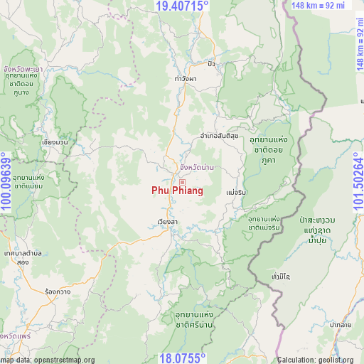
Phu Phiang GPS coordinates[2]
18° 44' 33.504" North, 100° 47' 58.236" East
| Map corner | latitude | longitude |
|---|---|---|
| Upper-left | 19.40715°, | 100.09639° |
| Center: | 18.74264°, | 100.79951° |
| Lower-right: | 18.0755°, | 101.50264° |
| Map W x H: | 148.1×148.1 km | = 92×92mi |
| max Lat: | 20.43353° ⇑6.1% North |
| Phu Phiang: | 18.74264° |
| min Lat: | ⇓93.9% South 5.77434° |
| min Long | Phu Phiang | max Long |
| 97.93288° | 100.79951° | 105.49506° |
| W 50.7%⇐ | ⇒49.3% E |
Elevation
Elevation of Phu Phiang is 221 m = 725 ft, and this is 95.5 m = 313 ft above average elevation for this country.
| Max E: |
1011 m = 3317 ft | 14.3% |
| Phu Phiang | 221 m 725 ft | |
| Avg. | 125.5 m = 412 ft | |
Min E: |
1 m = 3 ft | 85.7% |
See also: Thailand elevation on elevation.city.
Geographical zone
Phu Phiang is located in North Torrid zone (between Equator and Tropic of Cancer). Distance of this Northern Tropic circle is 521.9 km =324.3 mi to North.| Distance of | km | miles | from Phu Phiang |
|---|---|---|---|
| North Pole | 7923.1 | 4923.2 | to North |
| Arctic Circle | 5317.2 | 3304 | to North |
| Tropic Cancer | 521.9 | 324.3 | to North |
| Equator | 2084 | 1294.9 | to South |


Nearby cities:
15 places around Phu Phiang: (largest is in red/bold)
• Ban Luang
39.9 km =24.8 mi,  287°
287°
• Bo Kluea
58.8 km =36.5 mi,  39°
39°
• Chiang Klang
61.6 km =38.3 mi,  6°
6°
• Chiang Muan
54.5 km =33.9 mi, 287°
• Mae Charim
22.1 km =13.7 mi,  100°
100°
• Na Muen
63.2 km =39.3 mi,  193°
193°
• Na Noi
47.1 km =29.3 mi, 191°
• Nan
5.1 km =3.2 mi,  334°
334°
• Pong
71.3 km =44.3 mi,  309°
309°
• Pua
49.6 km =30.8 mi, 14°
• Rong Kwang
67.8 km =42.1 mi,  228°
228°
• Santi Suk
24.2 km =15 mi, 38°
• Song Khwae
69.4 km =43.1 mi,  351°
351°
• Tha Wang Pha
42.2 km =26.2 mi,  1°
1°
• Wiang Sa
17.2 km =10.7 mi,  201°
201°
Sources, notices
• [Note1] Compared only with cities in Thailand existing in our database
• [Src1] Map data: © OpenStreetMap contributors (CC-BY-SA)
• [Src2] Other city data from geonames.org with taken over terms of usage.
• [Src3] Geographical zone / Annual Mean Temperature by Robert A. Rohde @ Wikipedia
