Tha Pla geodata
Tha Pla (Uttaradit) is a seat of a second-order administrative division; located in Thailand in Asia/Bangkok (GMT+7) time zone. In our database, there are 331 cities with bigger population. Compared to other cities in Thailand, 86.6% of cities are located further ↓South; 62.2% of cities are located further →East and 52% of cities have lower elevation than Tha Pla. Note1


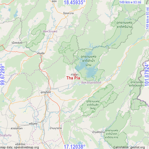
Tha Pla GPS coordinates[2]
17° 47' 28.032" North, 100° 22' 33.996" East
| Map corner | latitude | longitude |
|---|---|---|
| Upper-left | 18.45935°, | 99.67299° |
| Center: | 17.79112°, | 100.37611° |
| Lower-right: | 17.12038°, | 101.07924° |
| Map W x H: | 148.9×148.9 km | = 92.5×92.5mi |
| max Lat: | 20.43353° ⇑13.4% North |
| Tha Pla: | 17.79112° |
| min Lat: | ⇓86.6% South 5.77434° |
| min Long | Tha Pla | max Long |
| 97.93288° | 100.37611° | 105.49506° |
| W 37.8%⇐ | ⇒62.2% E |
Elevation
Elevation of Tha Pla is 122 m = 400 ft, and this is 3.5 m = 11 ft below average elevation for this country.
| Max E: |
1011 m = 3317 ft | 48% |
| Avg. | 125.5 m = 412 ft | |
| Tha Pla | 122 m = 400 ft | |
Min E: |
1 m = 3 ft | 52% |
See also: Thailand elevation on elevation.city.
Geographical zone
Tha Pla is located in North Torrid zone (between Equator and Tropic of Cancer). Distance of this Northern Tropic circle is 627.7 km =390 mi to North.| Distance of | km | miles | from Tha Pla |
|---|---|---|---|
| North Pole | 8028.9 | 4988.9 | to North |
| Arctic Circle | 5423 | 3369.7 | to North |
| Tropic Cancer | 627.7 | 390 | to North |
| Equator | 1978.2 | 1229.2 | to South |


Nearby cities:
15 places around Tha Pla: (largest is in red/bold)
• Chat Trakan
62 km =38.5 mi,  157°
157°
• Den Chai
40.4 km =25.1 mi,  301°
301°
• Fak Tha
58.1 km =36.1 mi,  66°
66°
• Lap Lae
38.9 km =24.2 mi,  246°
246°
• Laplae
38.9 km =24.2 mi, 246°
• Na Muen
53.5 km =33.2 mi,  34°
34°
• Nam Pat
33.4 km =20.8 mi,  102°
102°
• Nong Muang Khai
56.2 km =34.9 mi,  339°
339°
• Phichai
63.8 km =39.6 mi,  208°
208°
• Phrae
46.6 km =29 mi,  327°
327°
• Rong Kwang
61.2 km =38 mi,  354°
354°
• Sung Men
39.9 km =24.8 mi,  316°
316°
• Thong Saen Khan
35.9 km =22.3 mi,  187°
187°
• Tron
44.3 km =27.5 mi,  219°
219°
• Uttaradit
35.1 km =21.8 mi,  238°
238°
Sources, notices
• [Note1] Compared only with cities in Thailand existing in our database
• [Src1] Map data: © OpenStreetMap contributors (CC-BY-SA)
• [Src2] Other city data from geonames.org with taken over terms of usage.
• [Src3] Geographical zone / Annual Mean Temperature by Robert A. Rohde @ Wikipedia
