Nakhon Phanom geodata
Nakhon Phanom is a seat of a first-order administrative division; located in Thailand in Asia/Bangkok (GMT+7) time zone. With population of 34,595 people, there are 96 cities with bigger population in this country. Compared to other cities in Thailand, 83.1% of cities are located further ↓South; 97.3% of cities are located further ←West and 62.4% of cities have lower elevation than Nakhon Phanom. Note1


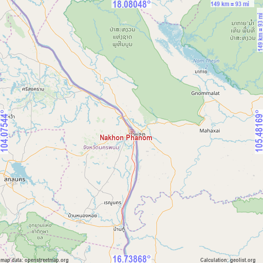
Nakhon Phanom GPS coordinates[2]
17° 24' 38.916" North, 104° 46' 42.816" East
| Map corner | latitude | longitude |
|---|---|---|
| Upper-left | 18.08048°, | 104.07544° |
| Center: | 17.41081°, | 104.77856° |
| Lower-right: | 16.73868°, | 105.48169° |
| Map W x H: | 149.2×149.2 km | = 92.7×92.7mi |
| max Lat: | 20.43353° ⇑16.9% North |
| Nakhon Phanom: | 17.41081° |
| min Lat: | ⇓83.1% South 5.77434° |
| min Long | Nakhon Phanom | max Long |
| 97.93288° | 104.77856° | 105.49506° |
| W 97.3%⇐ | ⇒2.7% E |
Elevation
Elevation of Nakhon Phanom is 154 m = 505 ft, and this is 28.5 m = 94 ft above average elevation for this country.
| Max E: |
1011 m = 3317 ft | 37.6% |
| Nakhon Phanom | 154 m 505 ft | |
| Avg. | 125.5 m = 412 ft | |
Min E: |
1 m = 3 ft | 62.4% |
See also: Thailand elevation on elevation.city.
Geographical zone
Nakhon Phanom is located in North Torrid zone (between Equator and Tropic of Cancer). Distance of this Northern Tropic circle is 670 km =416.3 mi to North.| Distance of | km | miles | from Nakhon Phanom |
|---|---|---|---|
| North Pole | 8071.2 | 5015.2 | to North |
| Arctic Circle | 5465.3 | 3396 | to North |
| Tropic Cancer | 670 | 416.3 | to North |
| Equator | 1935.9 | 1202.9 | to South |


Nearby cities:
15 places around Nakhon Phanom: (largest is in red/bold)
• Dong Luang
70.9 km =44.1 mi,  201°
201°
• Khok Si Suphan
67.1 km =41.7 mi,  232°
232°
• Kusuman
48.2 km =30 mi,  259°
259°
• Na Kae
59.5 km =37 mi,  209°
209°
• Na Wa
72.4 km =45 mi,  276°
276°
• Phon Na Kaeo
56 km =34.8 mi,  247°
247°
• Pla Pak
37.1 km =23.1 mi, 226°
• Renu Nakhon
41.4 km =25.7 mi, 195°
• Sakon Nakhon
72.5 km =45 mi, 247°
• Si Songkhram
60.9 km =37.8 mi,  293°
293°
• Tao Ngoi
79.6 km =49.5 mi, 234°
• Tha Uthen
26.5 km =16.5 mi,  313°
313°
• That Phanom
53.2 km =33.1 mi,  187°
187°
• Wan Yai
76.7 km =47.7 mi,  182°
182°
• Wang Yang
52.3 km =32.5 mi,  221°
221°
Sources, notices
• [Note1] Compared only with cities in Thailand existing in our database
• [Src1] Map data: © OpenStreetMap contributors (CC-BY-SA)
• [Src2] Other city data from geonames.org with taken over terms of usage.
• [Src3] Geographical zone / Annual Mean Temperature by Robert A. Rohde @ Wikipedia
