Phu Luang geodata
Phu Luang (Loei) is a seat of a second-order administrative division; located in Thailand in Asia/Bangkok (GMT+7) time zone. In our database, there are 331 cities with bigger population. Compared to other cities in Thailand, 79.8% of cities are located further ↓South; 62.7% of cities are located further ←West and 90% of cities have lower elevation than Phu Luang. Note1


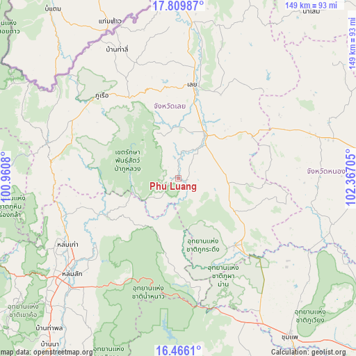
Phu Luang GPS coordinates[2]
17° 8' 21.12" North, 101° 39' 50.112" East
| Map corner | latitude | longitude |
|---|---|---|
| Upper-left | 17.80987°, | 100.9608° |
| Center: | 17.1392°, | 101.66392° |
| Lower-right: | 16.4661°, | 102.36705° |
| Map W x H: | 149.4×149.4 km | = 92.8×92.8mi |
| max Lat: | 20.43353° ⇑20.2% North |
| Phu Luang: | 17.1392° |
| min Lat: | ⇓79.8% South 5.77434° |
| min Long | Phu Luang | max Long |
| 97.93288° | 101.66392° | 105.49506° |
| W 62.7%⇐ | ⇒37.3% E |
Elevation
Elevation of Phu Luang is 277 m = 909 ft, and this is 151.5 m = 497 ft above average elevation for this country.
| Max E: |
1011 m = 3317 ft | 10% |
| Phu Luang | 277 m 909 ft | |
| Avg. | 125.5 m = 412 ft | |
Min E: |
1 m = 3 ft | 90% |
See also: Thailand elevation on elevation.city.
Geographical zone
Phu Luang is located in North Torrid zone (between Equator and Tropic of Cancer). Distance of this Northern Tropic circle is 700.2 km =435.1 mi to North.| Distance of | km | miles | from Phu Luang |
|---|---|---|---|
| North Pole | 8101.4 | 5034 | to North |
| Arctic Circle | 5495.5 | 3414.7 | to North |
| Tropic Cancer | 700.2 | 435.1 | to North |
| Equator | 1905.7 | 1184.1 | to South |


Nearby cities:
15 places around Phu Luang: (largest is in red/bold)
• Dan Sai
57.1 km =35.5 mi,  285°
285°
• Erawan
35.7 km =22.2 mi,  59°
59°
• Loei
39.6 km =24.6 mi,  9°
9°
• Lom Kao
54.1 km =33.6 mi,  238°
238°
• Lom Sak
60.1 km =37.3 mi,  228°
228°
• Na Klang
58.8 km =36.5 mi,  71°
71°
• Na Wang
48.6 km =30.2 mi, 64°
• Nam Nao
41.3 km =25.7 mi,  179°
179°
• Nong Hin
20.7 km =12.9 mi,  94°
94°
• Pha Khao
39.7 km =24.7 mi,  101°
101°
• Phu Kradueng
36.8 km =22.9 mi,  140°
140°
• Phu Pha Man
60.1 km =37.3 mi,  155°
155°
• Phu Ruea
47.4 km =29.5 mi,  317°
317°
• Tha Li
59.7 km =37.1 mi,  334°
334°
• Wang Saphung
21.1 km =13.1 mi,  31°
31°
Sources, notices
• [Note1] Compared only with cities in Thailand existing in our database
• [Src1] Map data: © OpenStreetMap contributors (CC-BY-SA)
• [Src2] Other city data from geonames.org with taken over terms of usage.
• [Src3] Geographical zone / Annual Mean Temperature by Robert A. Rohde @ Wikipedia
